pattidaniels.news

  • Ocean Blog
  • Africa Blog
  • America Blog
  • Asia Blog
  • About
The Laguna Mountains, east of San Diego in Cleveland National Forest, are home to a stretch of the Pacific Crest Trail.

The Laguna Mountains, east of San Diego in Cleveland National Forest, are home to a stretch of the Pacific Crest Trail.

Hot. Damn Hot!

September 10, 2018 by Patti Daniels

I spent only a month living on a ship in the Arctic this summer, but there were occasional moments when the desire to run - really run - on terra firma was strong enough to distract me from gorgeous ice floes and charismatic megafauna. When we landed at Grise Fjord, the northernmost settlement in Canada, I stared longingly at the dirt tract along the shore and wondered how far and fast I could run in gum boots, waders and a float coat. Back on the ship, a decent treadmill awaited in a cave-like room on a lower deck.

Back among rocks and roots in the lower 48, my legs and lungs are relearning how it feels to move. And right now, in southern California, they're remembering what it feels like to run in heat. This ain't the Arctic, anymore!

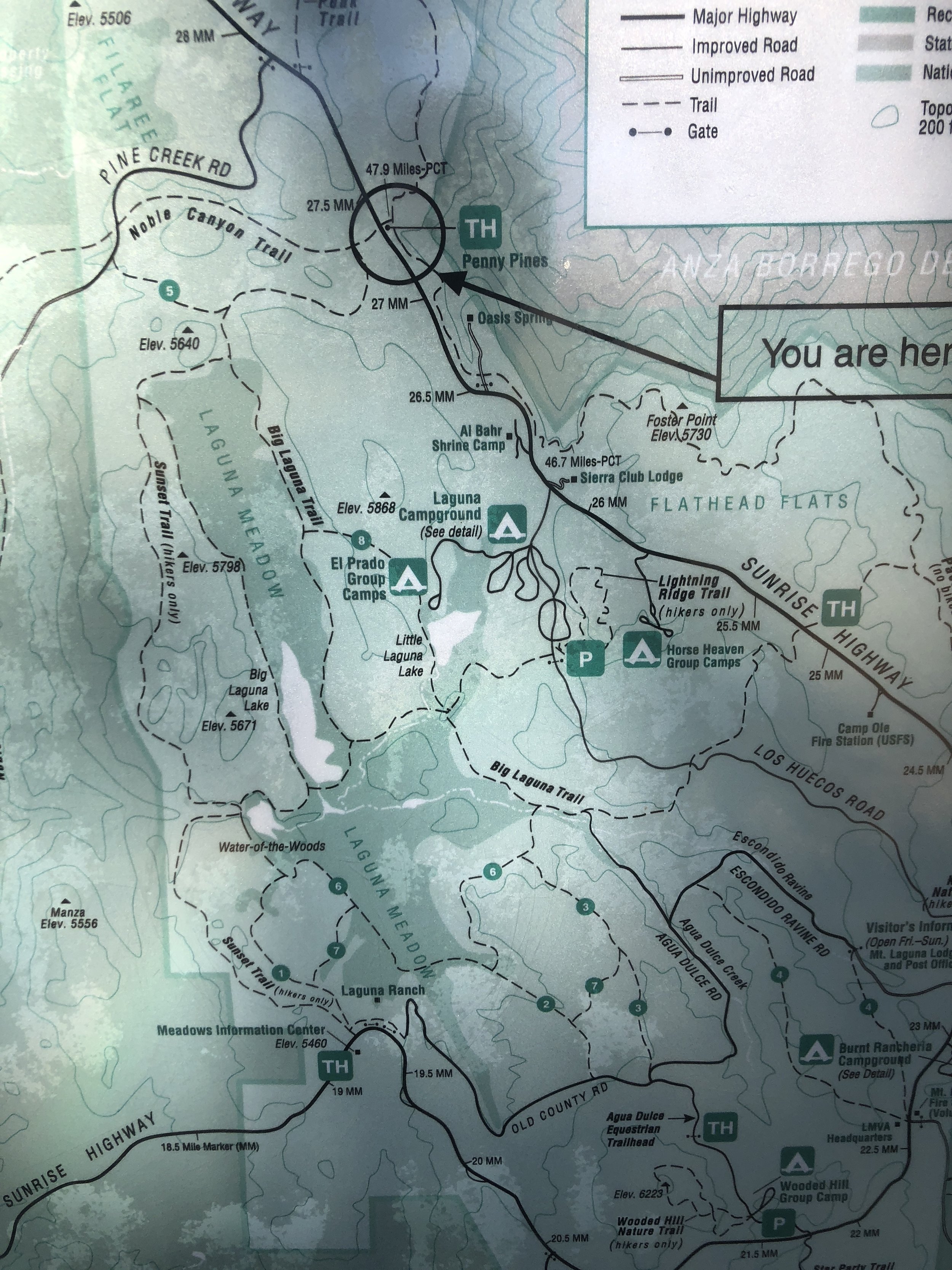
I am harboring ideas of running an ultramarathon next year, and also of heading to big mountains somewhere for a long backpacking trip before 2018 closes down. With that in mind, I drove east from San Diego past Alpine up into the Laguna Mountains to get in some miles on real trails. A guidebook suggested that singletrack and great scenery abounds on the Big Laguna Trail, and that's where I headed.

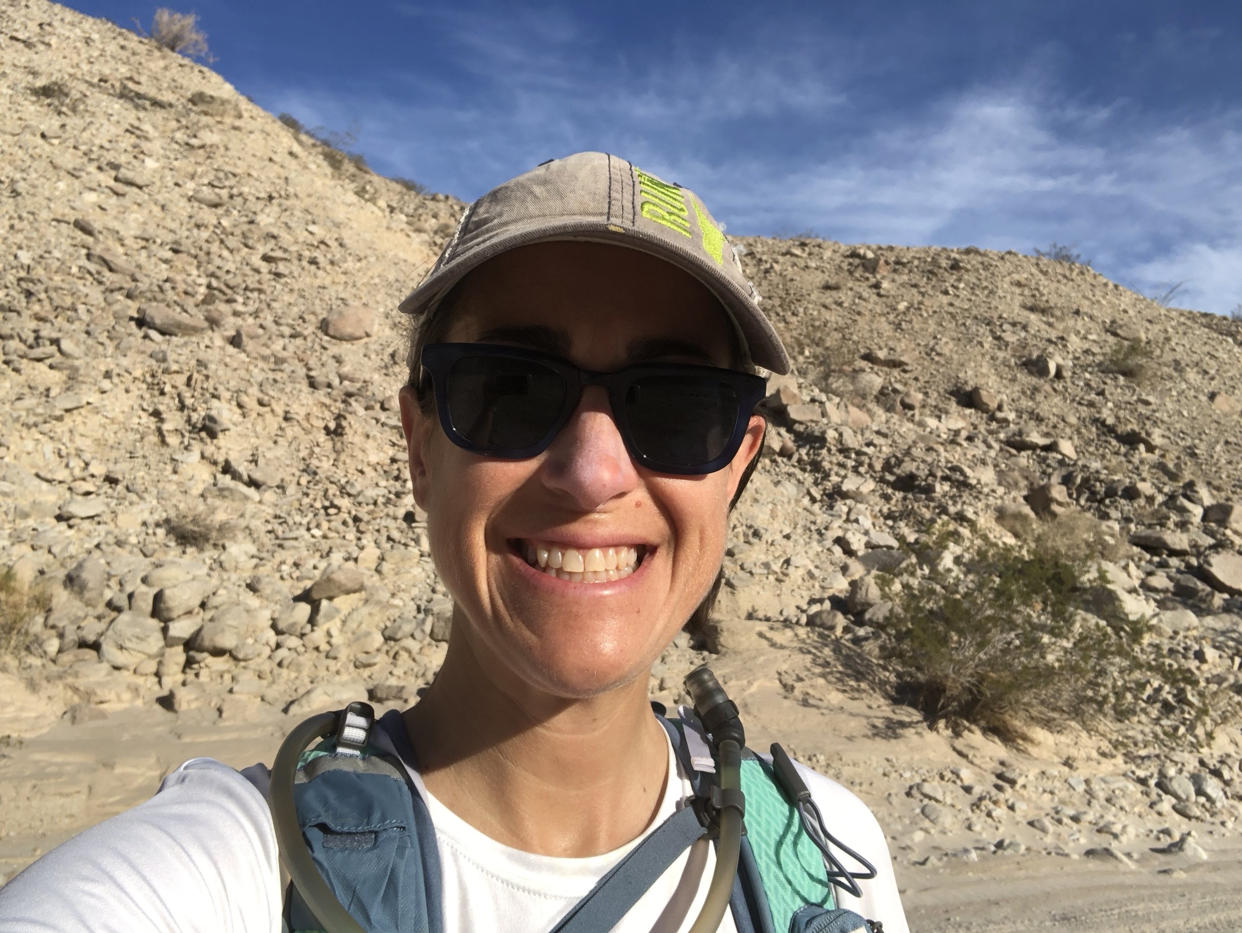
A lazy morning and an hourlong drive put me at the Penny Pines trailhead a little too late in the day, the temperature already in the mid-80s. But the parking area suggested plenty of other people were shrugging off the heat, and as I got my hydration vest together my spirits soared watching a few runners come through the trailhead.

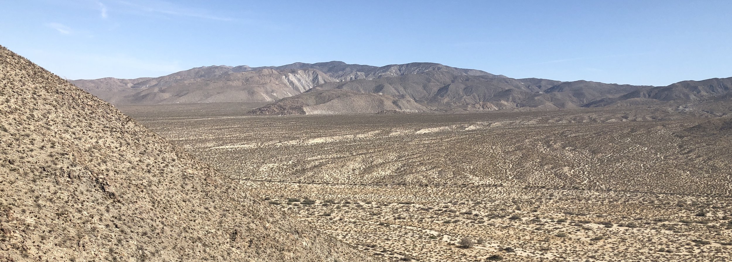
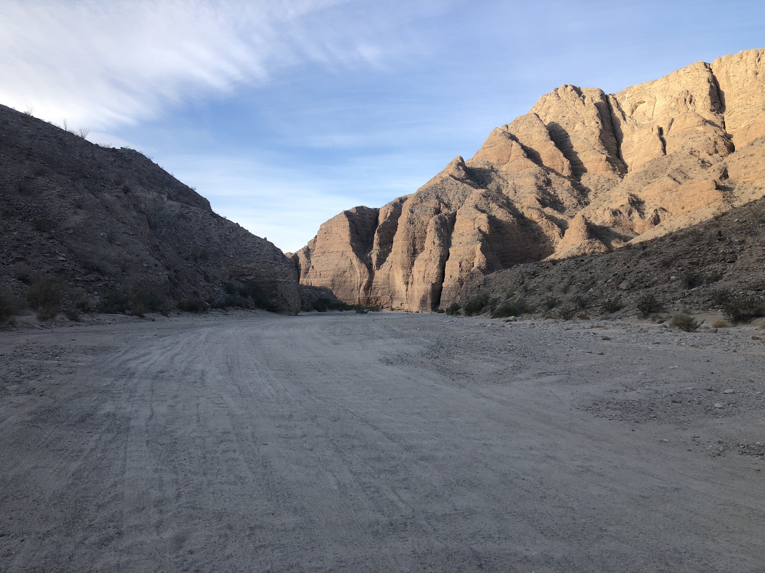
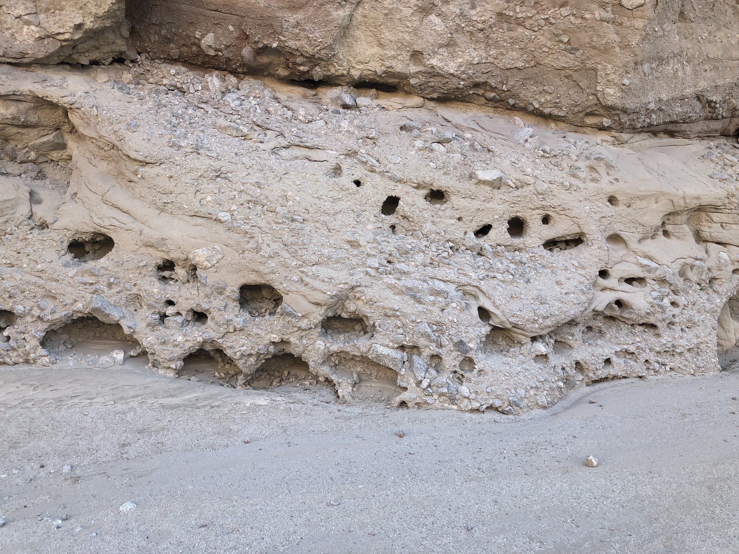
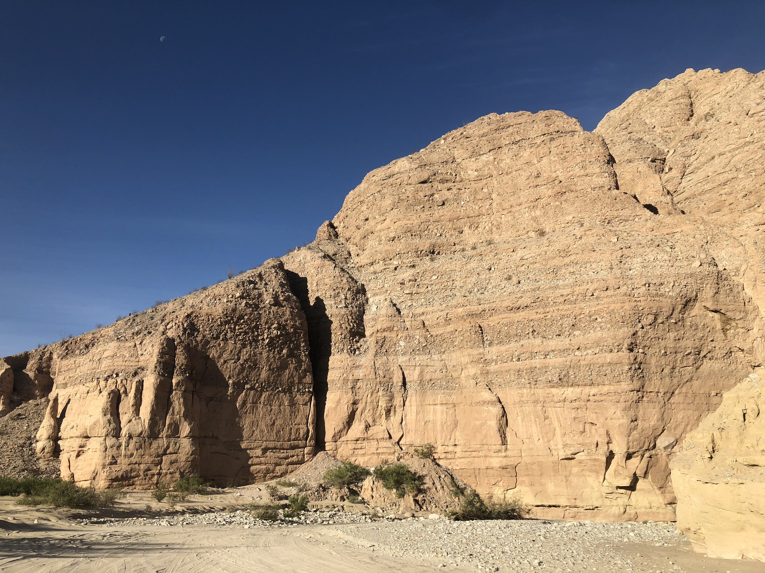
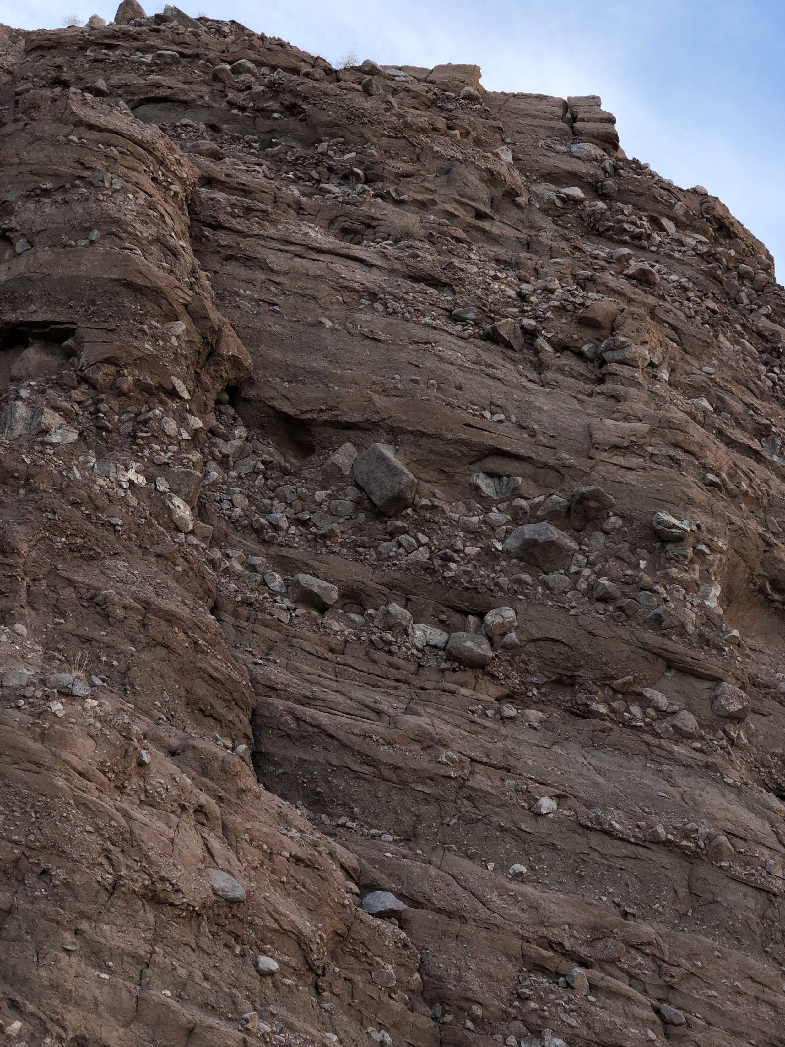
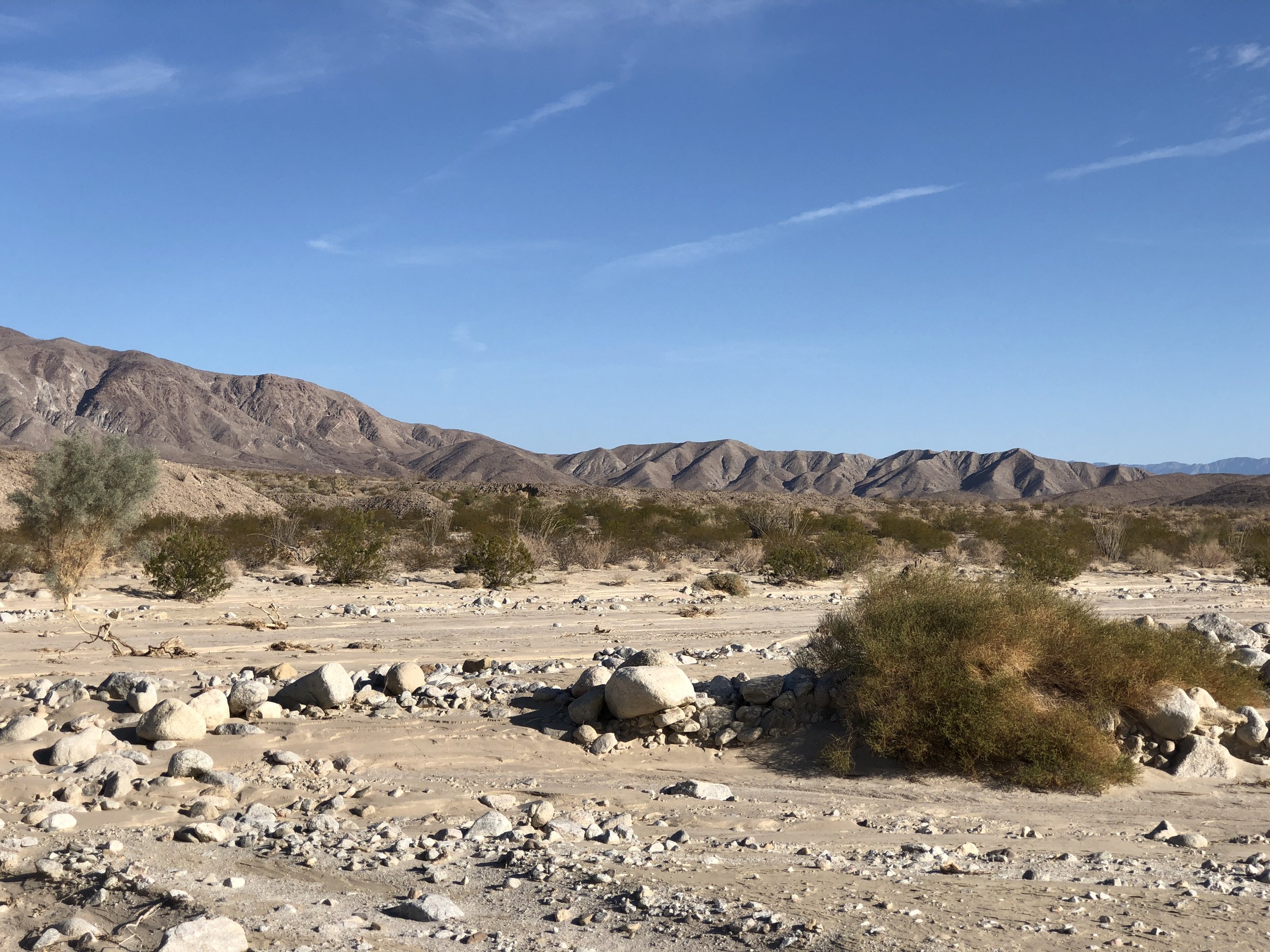
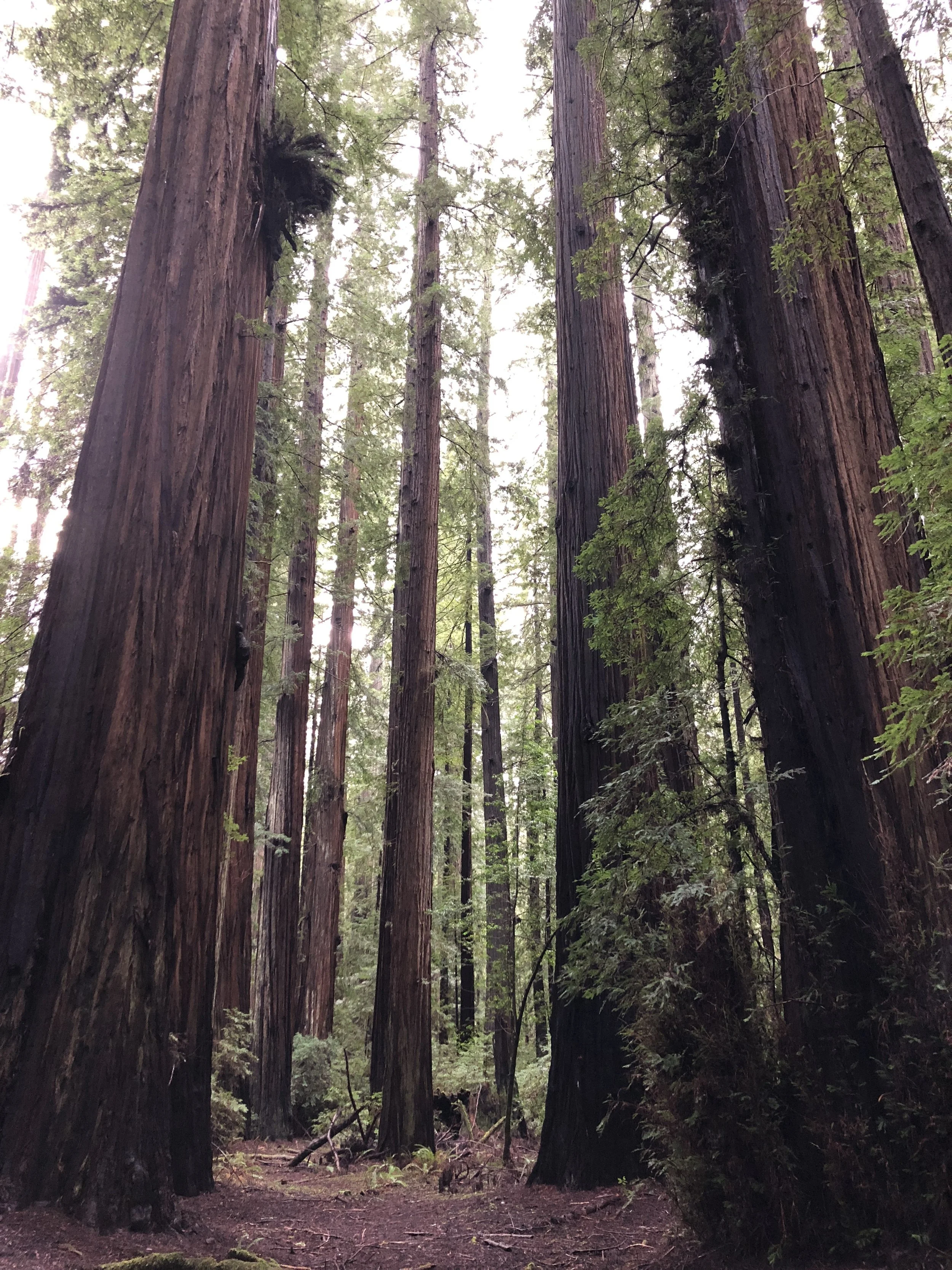
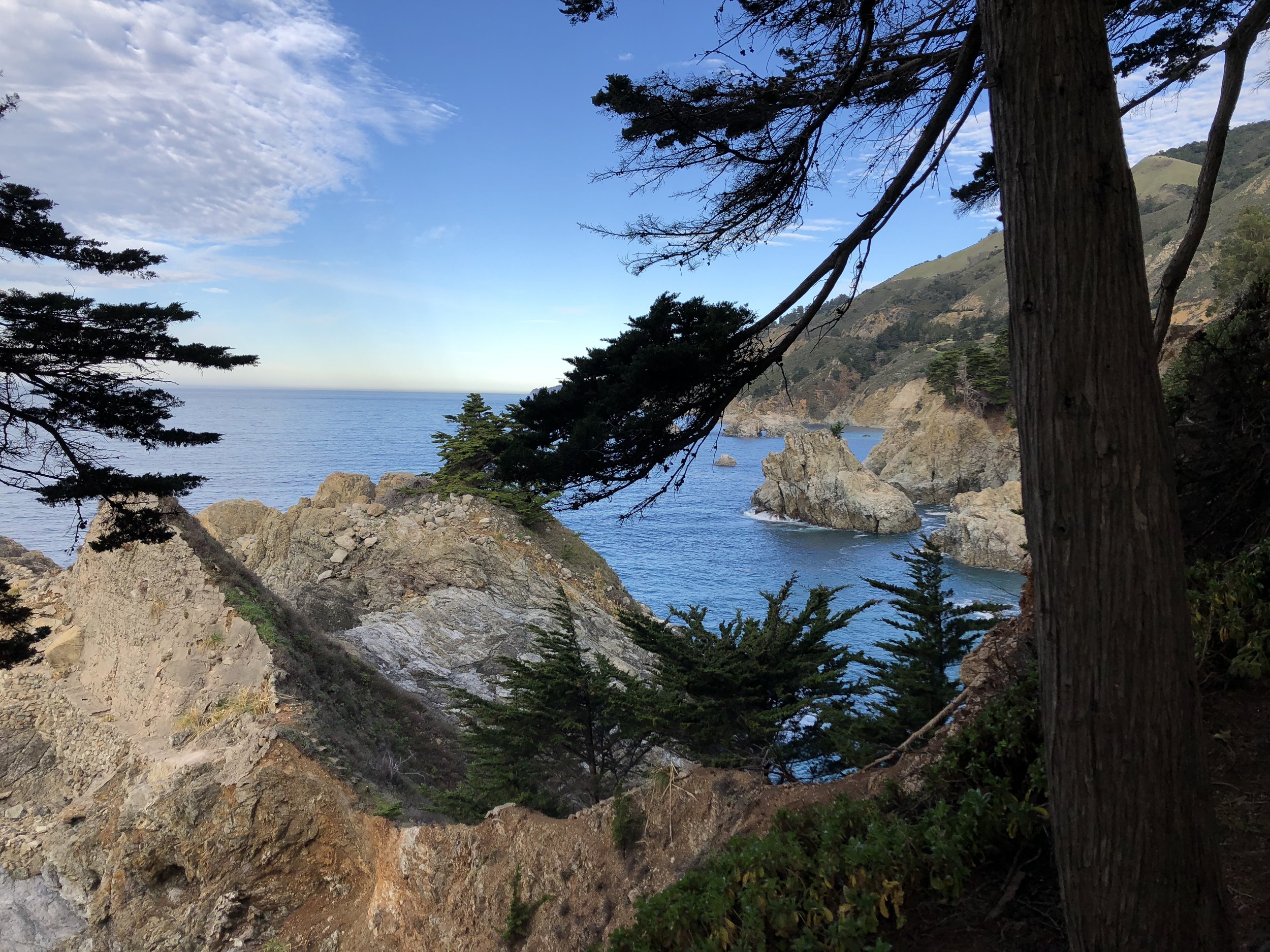
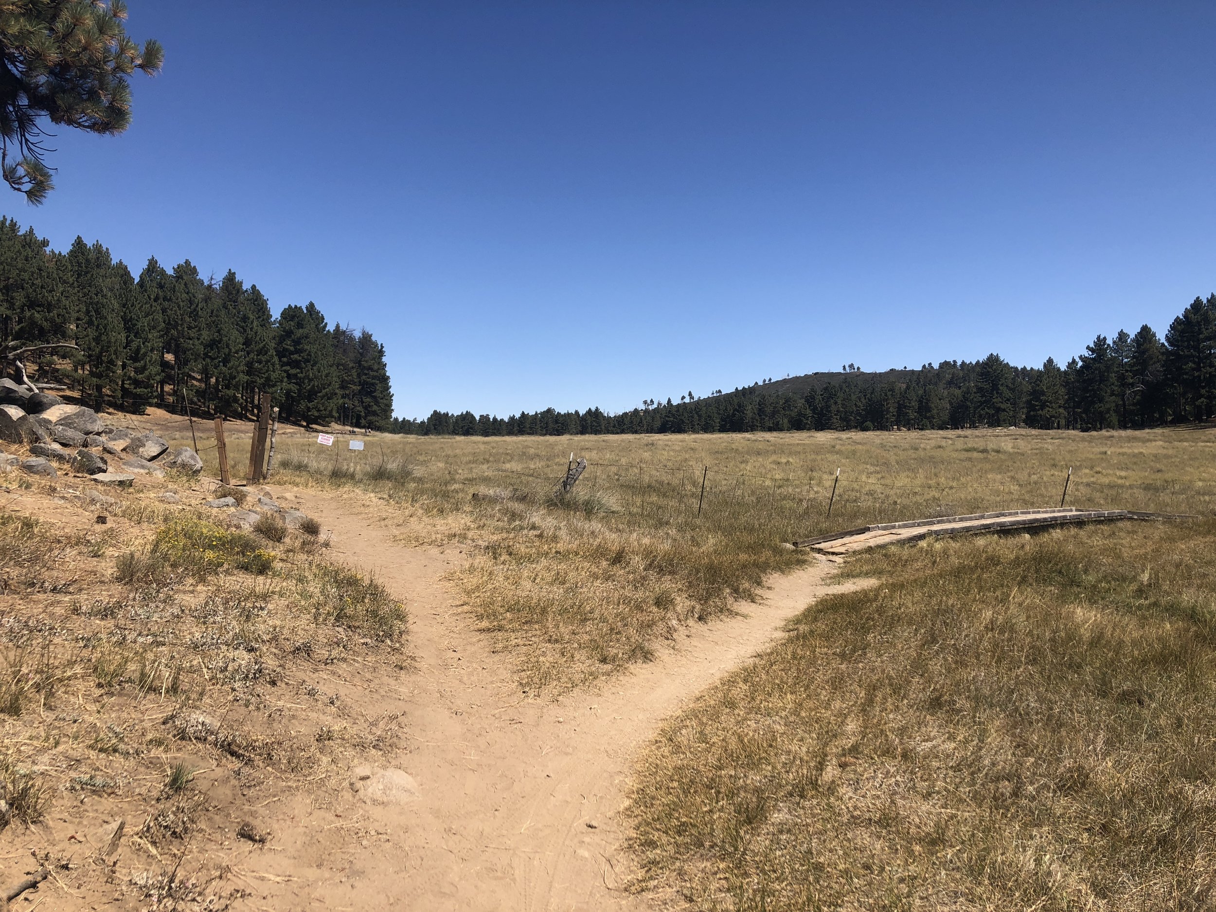
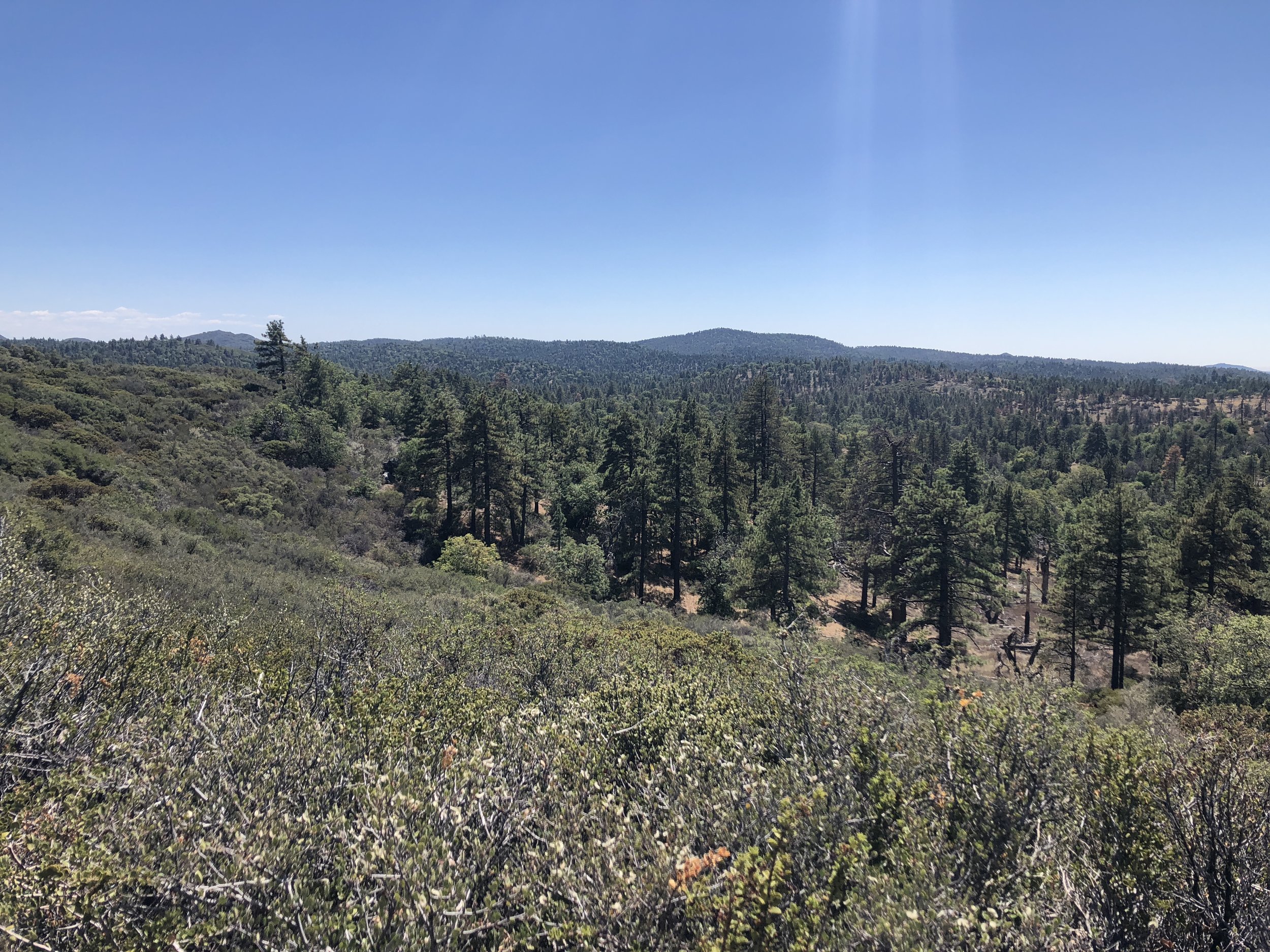
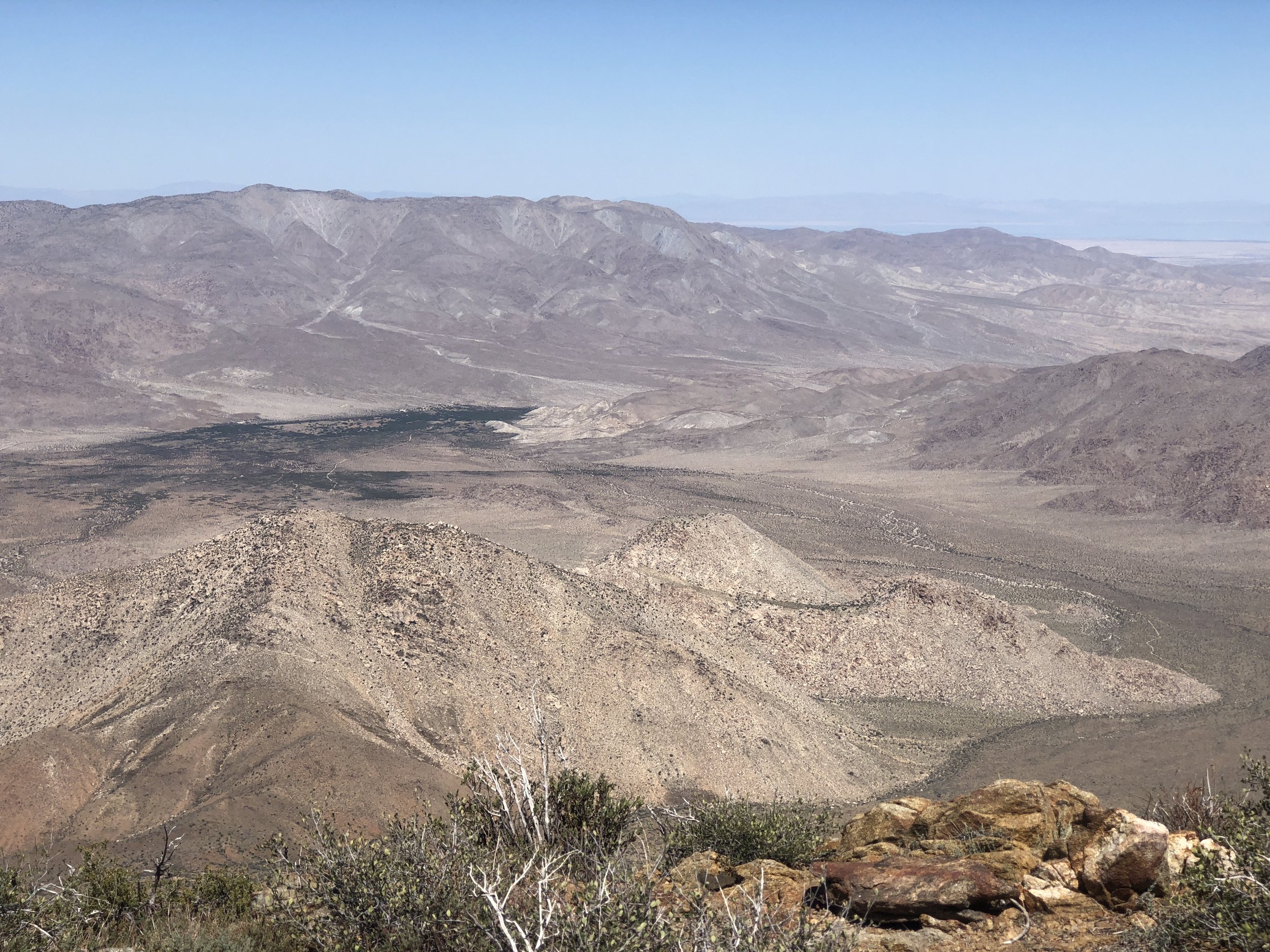
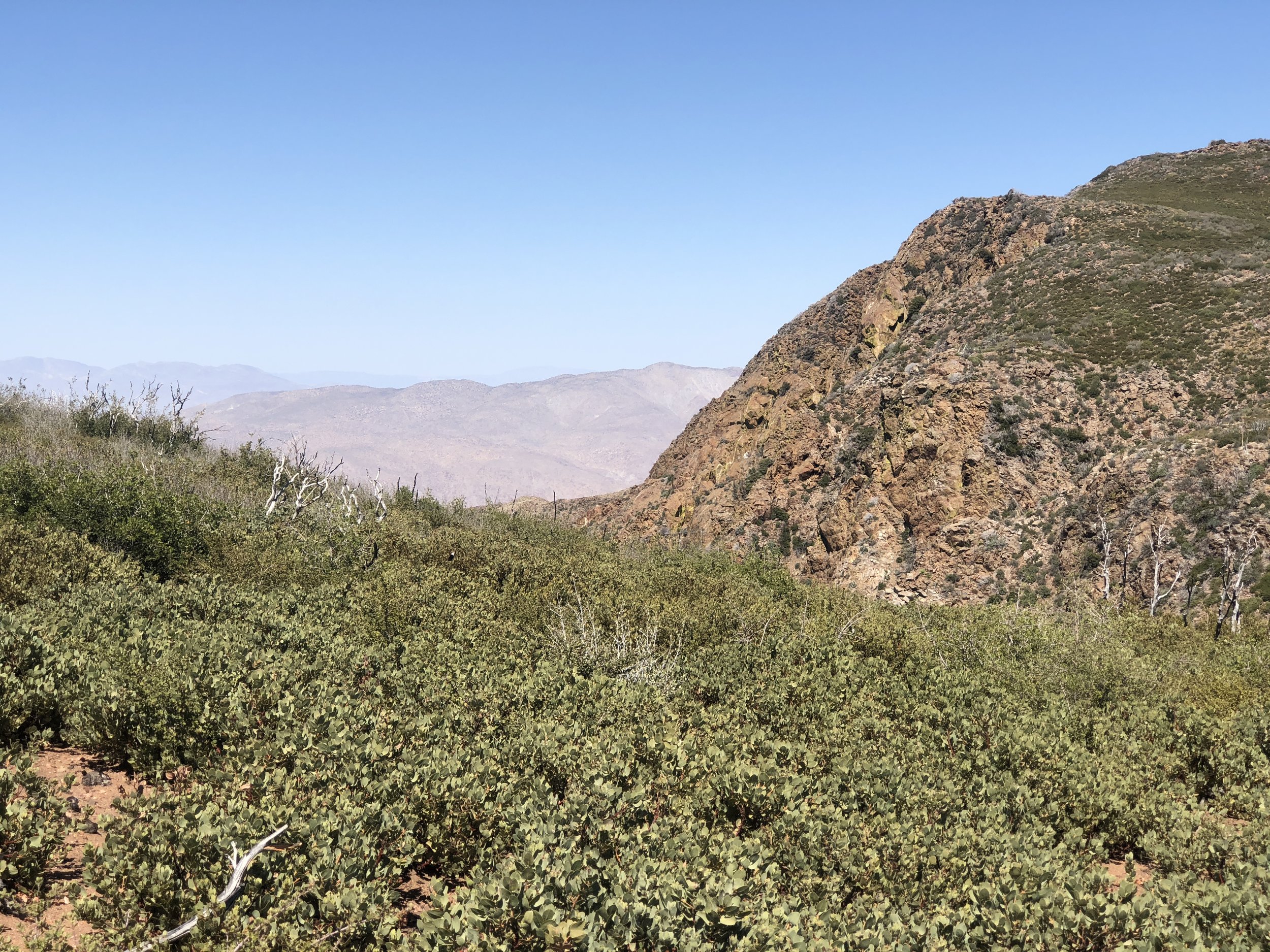
This region forms a dramatic seam between two landscapes. To the west, the pine forests and grassy meadows are a paradise of trails for hikers and mountain bikers, not to mention the clusters of cattle shading themselves in the trees. To the east, unrelenting desert. Barren, blistering, bleached mountains dive unforgivingly into boulder-strewn valleys.

The first half of my run swung west and then south through pines and meadows and lovely occasional shade, along barbed wire fencelines with gates courteously installed for walkers. I've never run in the area and I was dazzled by the options. The valleys and hillsides here are shot through with winding singletrack, dipping and turning and casting up new views. The first half-mile was a strain against the heat, the dry air and even the altitude, though it was only just above 5,000 feet. But then the gorgeous terrain stole my attention away from the effort of running and I just enjoyed cruising along the edge of Laguna Lake. (Less lake, more marsh.)

Walkers, occasional runners and many mountain bikers formed a cheerful tribe on the trails - not so many people that it felt crowded, but enough that when I got confused by the spiderweb of trail options (which was often) I could usually find someone to ask for directions.

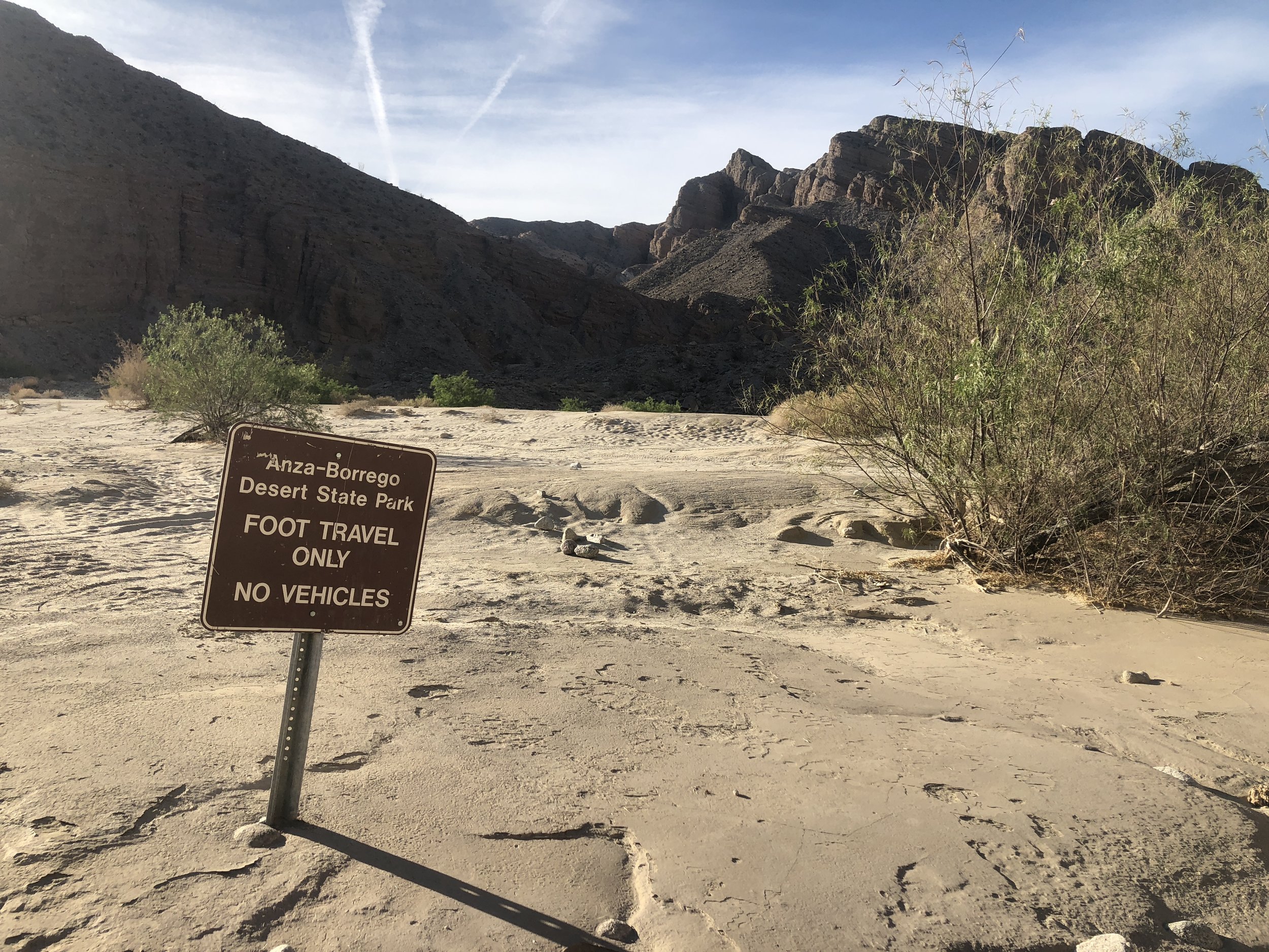
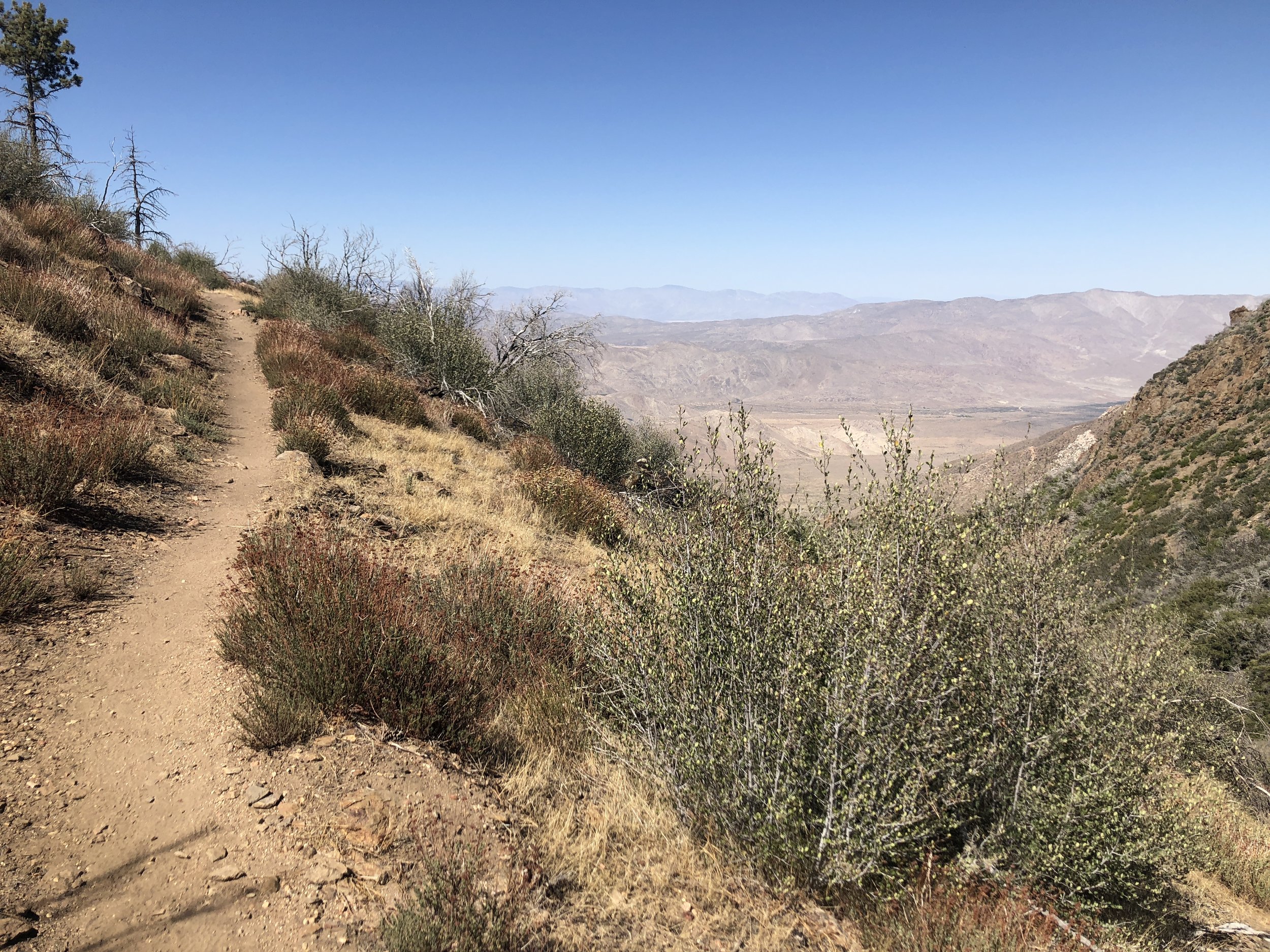
Around halfway, my navigational help came from two runners who were heading my way. I ran-hiked uphill with them through a stand of pines back to Sunrise Highway, about five miles south from the Penny Pines trailhead where I started. From there I crossed the highway and after a stretch linked up with the Pacific Crest Trail and headed north. Here, the trail makes tight, threaded turns at the rim edge of the mountains overlooking the Anza-Borrego desert. The heat was getting to me, possibly because it was really hot and possibly because staring down into the massive bowl of the desert really screws with your mind.

By the time I coasted back to Penny Pines, the thermometer read 94 degrees, but my hydration vest still had water to spare and I'd ripped through merely one sleeve of Clif Bloks. It was only 12 miles, I sheepishly told the runners who were out there for big miles.

But it felt like the start of something good.

 Trails, everywhere trails!
 When you come to a fork in the road…
 Huge pine cones!!
 I didn’t hear any woodpeckers, but they’ve definitely had a good time here.
 Looking southwest from the PCT.
 Looking northeast from the PCT.
 Fantastic views, fantastic heat.
 Last bit of the PCT before turning back to the trailhead.
 Trails, everywhere trails!  When you come to a fork in the road…  Huge pine cones!!  I didn’t hear any woodpeckers, but they’ve definitely had a good time here.  Looking southwest from the PCT.  Looking northeast from the PCT.  Fantastic views, fantastic heat.  Last bit of the PCT before turning back to the trailhead.

[Big Laguna Loop, September 8, 2018]


September 10, 2018 /Patti Daniels
running, laguna mountains, california, PCT, Big Laguna Trail
Comment
Hot Stuff! Anza-Borrego Desert, east of San Diego.

Hot Stuff! Anza-Borrego Desert, east of San Diego.

Quick Run in the California Desert

July 19, 2018 by Patti Daniels

I got it in my head this spring that I wanted to go for a run in the desert. Ninety minutes in the car, and I could have a huge number of trails to choose from across wild terrain. But a quick look at the forecast and I realized that, even in May, it was already too hot out there. Unless...

San Diego County begins at the ocean's edge, ripples east over canyons and foothills, dips into the flat heat trap of East County and then rises fast into the conifer forests of the mountains. Keep going down the far side of mountains and you will meet the massive Anza-Borrego Desert, where San Diego County yields to the furious temperatures and bizarre moonscape of Imperial County. Growing up in East County, I could reliably feel better about 100-degree summer days by looking at the temps east of me in Borrego Springs, easily 10-20 degrees hotter than our air conditioned suburb.

But by May, the daytime temps in Anza-Borrego were already hitting triple digits. To pull off a run out there, I'd need to hit the trail at dawn when the temperature would be hovering in the reasonable 80s, before launching its full assault on the day.

And so, camping!

I threw together equipment and a few gallons of water, and the hit the road mid-afternoon on a sunny day in the first week of May. The Anza-Borrego State Park visitors center told me when I pulled in around 5 p.m. that it was 105 degrees; the volunteers there told me little else. (Seriously, they were least helpful state park volunteers I've encountered, expressing surprise and doubt that anyone would want to visit there.)

Excellent state park facilities! Each site has its own shade pagoda.

Excellent state park facilities! Each site has its own shade pagoda.

I drove out to Tamarisk Grove Campground and discovered it was... empty. Finding the ranger station closed, I drove the loops of vacant campsites and wondered if I could brave staying here alone till I found a family of four happily camped in the center of the park. Their easy vibe was all the reassurance I needed, and I quickly pitched my tent, lit up the camp stove and studied the trail maps in the setting sun.

The trail I wanted to try is in the southeast corner of the park in an area called Fish Creek Wash. An ancient sea covered this arid, bleached landscape and when it receded, the water left a fossil record of what once was. Fish Creek (note: no creek exists here) runs through a geographic feature called Split Mountain, and that was my target for an out-and-back run that I could shorten or lengthen depending on the heat of the air, and the speed of my legs.

I was up before dawn, broke down my simple campsite by the light of a headlamp and scarfed a banana as I drove further east toward Split Mountain. The trailhead directions didn't exactly match the terrain, and after driving my tiny city-suitable car off-road roughly toward the trailhead, I decided to park and start running for fear of my tires getting stuck in the loose sand that covered the hardpack surface.

The sun rose fast and before I knew it, I was running in the full light of the morning on a wide, side-winding track tucked into awesome rock formations. Walls of rock created stretches of shade and plenty to gawk at as I followed the S-curves of a long-lost river bed. The footing was kind of terrible though (I had dismissed a note in a trail guide that recommended only running here after a winter rain, when the loose sand would firm up into a runnable surface) and it made the run a harder effort than I expected.

But so worth it!! The rock walls were fascinating: striated layers of sediment leaned and tilted in wild directions; some layers were solid, rust-colored rock and other layers were a jumbled mess of gravel and stones. Wind, water and time had scooped out pockets of rock from the walls, and in some places crevices opened into shallow caves. Cactus and shrub-filled islands of sand and rock pushed the trail around curves, and I was constantly getting a new view of the surrounding landscape. Openings between the rocky hills allowed in big gulps of blue sky. And underfoot, pebbly bleached sand formed a perfect track that left no worry about staying on trail.

IMG_6515.JPG
IMG_6522.JPG
IMG_6524.JPG
IMG_6518.JPG
IMG_6535.JPG
IMG_6529.JPG
IMG_6515.JPG IMG_6522.JPG IMG_6524.JPG IMG_6518.JPG IMG_6535.JPG IMG_6529.JPG

I wasn't looking at my mileage or the time when I decided to head back. The air was hot, but I had plenty of water in my race vest. What triggered my turn-around was a sudden, inexplicable change in my own mood. I had been cruising on the joy of having decided to do something inconvenient and undesirable to some people; I was full of appreciation for the solitude of the desert and simplicity of the elements.

Gah, snake!

Gah, snake!

And then for no reason I could discern, my thoughts became crowded: how far out from the main road was I; how hard would it be to reach help if I needed it; why hadn't I stuffed a first aid kit in my vest; and exactly how many rattlesnakes and scorpions could be lurking in the crevices of the rock walls surrounding me? Everyone tells you not to go adventuring alone.

I paused long enough to anesthetize these doubts: I took in the gorgeous terrain that surrounded me, had a logical chat with myself to recognize that I was, in that moment, totally safe and healthy, and then I turned and beat it back toward my car. 

In Travels With Charley: In Search Of America, John Steinbeck writes about the formidable desert just north of here: "The Mojave is a big desert and a frightening one. It’s as though nature tested a man for endurance and constancy to prove whether he was good enough to get to California." The bragging, nativist Californian in me has always loved those lines, and I appreciate them a bit more sincerely now.

So much movement and history in these rocks!

So much movement and history in these rocks!

[May 6-7, 2018: Anza Borrego State Park, California]

July 19, 2018 /Patti Daniels
travel, running, desert, Anza-Borrego, camping, california
Comment
Lets do this! San Diego County Registrar of Voters.

Lets do this! San Diego County Registrar of Voters.

Vote Early, Vote Often

May 22, 2018 by Patti Daniels

I am an elections junkie.

Regardless of the state, or country, I am fascinated by whom people choose to vote for, what meaning they assign to the votes they cast, the voting systems we create and how those systems create both access and barriers.

In the U.S., we grow up internalizing the simple message of one person, one vote. But the reality of how we vote and who votes is infinity more complicated.

I officially moved back to California last summer, but I’ve spent only a few scant weeks in the state since then. But with California’s June primary election looming, I went to the San Diego County Registrar of Voters office last week and made myself a California voter again, 25 years after first voting here as a teenager. For a few years, I voted by mail from college in Maine, receiving the massive California voter guide that describes each proposition and provides each candidate's personal statement. Then one year Maine had a juicy election that prompted me to move my registration to my temporarily adopted state.

IMG_6596.JPG

When I moved to Vermont after college, I went into the town office in Waitsfield ahead of the next election and took the Voter’s Oath. This is a curiosity of Vermont elections that I still find endearing: every elected official swears an oath to the constitution, and every voter swears an oath to cast their vote with their best intentions and on their own behalf.

For a person who loves to vote, Vermont is an ideal place: you get a LOT of opportunities to an anonymously say your piece. General Election in November, Town Meeting in March, open Primary Elections held separately for each party, an occasional special election and sometimes repeated school budget votes, if the budget fails to pass the first time.

Voting in Waitsfield, Vermont, (population 1,600) in the late 90s was a step back in time. The ballots weren’t fill-in-the-bubble forms, but printed pieces of paper that were stuffed into lock boxes. One year I volunteered to count ballots, which involved teams of two counting aloud, making tally marks to tabulate the results and double-checking each other’s work. I was thrilled and horrified that this was the fundamental cornerstone of American democracy: volunteers in a school cafeteria with golf pencils and scratch paper. (I also remember the Town Clerk one year making a plea to voters to buy modern voting machines, but the voters didn’t agree it was worth the expense.)

My experience with Vermont elections in the last 10 years was unusual because I covered them intensely as a news producer. I voted in every General Election and Town Meeting, but I sat myself out of every Primary Election. (This is a point of endless navel gazing among journalists and media critics — should journalists vote? My own dividing line is to avoid Primaries because Primaries are for parties; but I vote in the General because the General Election is for the people, and journalists are people, too.)

And now I’m a California voter again, and the experience of voting here was radically different than the simple, huge-font Scan-Tron paper ballots I used most recently in Winooski, Vermont (population 7,100). So different are these ballots, that I am again amazed that we are all living in the same county, embracing the same fundamental idea of one person, one vote, while our method of executing that ideal bears no resemblance from one jurisdiction to another. (Federalism!)

I registered to vote and voted early at the same time at the registrar’s office in San Diego (population 1.4 million). I was not asked for ID or proof of residence, but I did fill out a form stating my San Diego address and the address where I was previously registered to vote in Winooski. It was pretty simple, and they asked me to wait a few minutes while my registration migrated through their computer system, and then I could walk across the hall to vote.

IMG_6590.JPG
IMG_6589.JPG
IMG_6590.JPG IMG_6589.JPG

The touch-screen computer voting machines at this office serve voters from all voting districts across the county and so to ensure that my screen pulled up the correct ballot, the registrar coded a temporary access card with my address and handed it to me as I went in to vote. At the voting machine, I inserted the card and up came the ballot that covered everything from the governor’s race to my local Board of Supervisors seat. California ballots are notoriously long and complex, and voters are encouraged to study the voter’s guide and make a note of their choices, so that they can vote efficiently. I paged through the voter guide I had marked up, entered my votes on the touch screen computer, and finally got to the end of the ballot.

The computer then asked me to review all my votes and make sure they are marked as I intended, and then it started printing a paper receipt of the votes. Similar to a cash register receipt, it printed my votes a few at a time, asked me to verify that the printout matched what I checked on the screen. And then it sucked the receipt back into the voting machine to save for an eventual recount when someone doesn’t like how this election turns out.

fullsizeoutput_1c11.jpeg
IMG_6588.JPG
fullsizeoutput_1c11.jpeg IMG_6588.JPG

When I finished voting, I removed the access card and returned it to the registrar, who promised that the card only knows my address and does not record my votes. It will be wiped and reused for the next person who comes in to vote here.

California’s actual Primary Election is June 5, and it will narrow the fields of candidates in statewide races down to two people. For a few election cycles, California has used this non-partisan primary system: it doesn’t matter what party (if any) that a voter registers for, nor does it matter what party (if any) a candidate claims. Every voter casts one vote for their top choice, and the top two vote getters will be on the General Election ballot in November. In blue California, this will could mean a General Election that has two Democrats running against each other for governor.

Beyond the machinery and the complexity, one more thing about voting in California stood in contrast to Vermont: the “I Voted” stickers comes in many languages.

Yo vote!

Yo vote!

[May 2018]

May 22, 2018 /Patti Daniels
california, voting, election, vermont
Comment
This coast just doesn't quit.

This coast just doesn't quit.

West Coast, Best Coast

February 08, 2018 by Patti Daniels

Growing up in California, I had a specifically spatial concept of cardinal directions. West wasn't so much a point on a compass but rather, West was were the ocean stretched to the horizon. When I lived in Maine, this unassailable sense of place tripped me up constantly. I had to really focus to remember that East Coast was an actual coast, on an actual though far inferior ocean. In Vermont, I could at least rely on Lake Champlain defining the state's western border; west is water, even if that water is sadly lacking in waves, salt and the demonstration of infinity.

This mentality of West Coastness is still so ingrained in me that in the cortex of my reptilian brain, I am subconsciously reassured that whatever weird places people are putting their oceans in other parts of the globe, California got it correct. Everything is normal in California.

So when I first encountered Oregonians and Washingtonians years ago, I didn't even realize my inherent bias. As far as I was concerned, the Pacific was California's ocean, and we were generous to let those other states park themselves near it. I was shocked to discover that people from Oregon and Washington didn't take too kindly to my Californiacentrism, which was reinforced without subtly when I tried to pump my own gas in Oregon.

Fast-forward to January 2018: I got my little car with Vermont license plates out of storage in the Pacific Northwest and road tripped down the entire West Coast from Seattle to San Diego. The new layer of geography personification was that I imagined that Vermont plate created instant goodwill around me. Who doesn't love Vermont?! And at the very least, it papered over my California roots. If I did something stupid, they wouldn't immediately curse the entire behemoth state to the south.

Two themes of my road trip emerged: 1) reconnecting with friends and family, and 2) camping and quality time in nature. I made fast tracks all the way south, but even without time to linger the days were filled with stunning sights and fantastic reunions.

WASHINGTON

 Who parks a Lime Bike way out at the end of a deserted peninsula in a rainstorm? Seriously, who does that?

Who parks a Lime Bike way out at the end of a deserted peninsula in a rainstorm? Seriously, who does that?

 Very cool floating pathway that wiggles across water and scraggly bits of exposed land from Foster Point to East Montlake, Seattle.

Very cool floating pathway that wiggles across water and scraggly bits of exposed land from Foster Point to East Montlake, Seattle.

 And here at the University of Washington Boathouse and Montlake Cut, I could only think about The Boys In The Boat.

And here at the University of Washington Boathouse and Montlake Cut, I could only think about The Boys In The Boat.

 Huge puddles and slippery footing all the way through the Arboretum.

Huge puddles and slippery footing all the way through the Arboretum.

 Who parks a Lime Bike way out at the end of a deserted peninsula in a rainstorm? Seriously, who does that?  Very cool floating pathway that wiggles across water and scraggly bits of exposed land from Foster Point to East Montlake, Seattle.  And here at the University of Washington Boathouse and Montlake Cut, I could only think about The Boys In The Boat.  Huge puddles and slippery footing all the way through the Arboretum.


OREGON

 Witch's Castle, Forest Park, Portland. If I lived here, I would run in this park forever.

Witch's Castle, Forest Park, Portland. If I lived here, I would run in this park forever.

 I came *this close* to putting Lila the Cat in the tote bag and whisking her away on my road trip. What a sweetheart!

I came *this close* to putting Lila the Cat in the tote bag and whisking her away on my road trip. What a sweetheart!

 Vancouver, Washington. Not having any of it.

Vancouver, Washington. Not having any of it.

 Star Trees in Salem, on the north edge of the Willamette University campus. Big time high school nostalgia here.

Star Trees in Salem, on the north edge of the Willamette University campus. Big time high school nostalgia here.

 Lo, the only state capitol I saw on this trip. Not so much interested in architecture, are we Oregon?

Lo, the only state capitol I saw on this trip. Not so much interested in architecture, are we Oregon?

 Hayward Field pilgrimage. (University of Oregon campus, Eugene.)

Hayward Field pilgrimage. (University of Oregon campus, Eugene.)

 Stop Pre. (Coos Bay.)

Stop Pre. (Coos Bay.)

 Native Oregonians.

Native Oregonians.

 Ok, it's pretty hard to deny that Oregon's coast is also pretty fantastic.

Ok, it's pretty hard to deny that Oregon's coast is also pretty fantastic.

 Witch's Castle, Forest Park, Portland. If I lived here, I would run in this park forever.  I came *this close* to putting Lila the Cat in the tote bag and whisking her away on my road trip. What a sweetheart!  Vancouver, Washington. Not having any of it.  Star Trees in Salem, on the north edge of the Willamette University campus. Big time high school nostalgia here.  Lo, the only state capitol I saw on this trip. Not so much interested in architecture, are we Oregon?  Hayward Field pilgrimage. (University of Oregon campus, Eugene.)  Stop Pre. (Coos Bay.)  Native Oregonians.  Ok, it's pretty hard to deny that Oregon's coast is also pretty fantastic.

CALIFORNIA

Humboldt Redwoods State Park

Trail run in the Rockefeller grove turned into endless gawking at old growth forest.

Humboldt Redwoods State Park

These trees are not small.

Humboldt Redwoods State Park

Mini Cooper! With big trees!

Marin Headlands
Marin Headlands

My first return since attempting the North Face 50 miler. The hike this time was significantly easier....

San Francisco
San Francisco

California Street!

San Francisco
San Francisco

Incredible view, just before the sun dipped below the horizon.

San Francisco
San Francisco
Santa Cruz
Santa Cruz

New Brighton State Park. I hadn't planned for s'mores but the campground host gave me free firewood, and another camper gave me matches and it was like the universe was telling me something.

Big Sur
Big Sur

This funky promontory is home to a historic lighthouse, an rock jutting out from the coast, with red shaggy cows grazing in the meadow. I pulled over to to gawp at the sight of it, and decided in less than 45 seconds that I need to find a way to live at that lighthouse for a few months.

Big Sur
Big Sur

Cows! I haven't seen cows in so long!

Big Sur
Big Sur

You gotta be kidding me. Nearby a sign read, "Next gas: 40 miles."

Big Sur
Big Sur

This red arrow points to two campsites on a cliff overlooking McWay Falls, part of at Julia Pfeiffer Burns State Park. Major hat tip to my friend Walter who told me about this!

Big Sur
Big Sur

View from my campsite at Julia Pfeiffer Burns State Park.

Big Sur
Big Sur

Notoriously, capturing distant images at night is not easy on a iPhone. But this near full moon was so crazy intense, it almost shows up in this picture!

Salinas
Salinas

The woman who sold me an entrance ticket at the John Steinbeck National Center asked, "Is it your first visit here?" "No," I said. "It's more like visiting an old friend." (This particular mannequin of Steinbeck in the gift shop isn't his best look.)

Central Coast
Central Coast

Morro Bay! I had heard this name and seen it on a map, but didn't know what to expect. So pretty!

Central Coast
Central Coast

Another spectacular California sunset. This one was followed nine hours later by a lunar eclipse, with the full moon hanging high in the western sky above the ocean. All night it was so, so bright that it seemed like the lights were on outside my tent. And then in the hours between 3:00-5:00 a.m. the sky went dark and the moon faded and turned red.

Central Coast
Central Coast

Morro Rock at Morro Bay. (I have conveniently cropped out the power plant just to the left of this scene....)

Central Coast.
Central Coast.

San Luis Obispo's bubblegum wall. Huh.

Central Coast
Central Coast

Tidepools in Goleta, Coal Oil Point. Anenomes everywhere!

Central Coast
Central Coast

A high school science class was there too, and found these "sea hairs." (I would call them enormous slugs, but tomato-tomahto.)

Central Coast
Central Coast

Anenomes out of water, all closed up and waiting for the tide to rescue them.

Central Coast
Central Coast

Evening run in Isla Vista: I noticed these orange trees and lavender shrubs are growing in the sidewalk beauty strip. How cool is that?!

Humboldt Redwoods State Park Humboldt Redwoods State Park Humboldt Redwoods State Park Marin Headlands San Francisco San Francisco San Francisco Santa Cruz Big Sur Big Sur Big Sur Big Sur Big Sur Big Sur Salinas Central Coast Central Coast Central Coast Central Coast. Central Coast Central Coast Central Coast Central Coast

REUNIONS!

Portland
Portland

One the funniest people I know, Bill Beadie.

Larkspur
Larkspur

Heidi and Robin, friends from Vermont, treated me to 16 scoops of weird ice cream, including olive tapenade. Curiously good!

San Francisco
San Francisco

Lisa, friend from Antarctica and many adventures since. Inspiring athlete, clear-thinking sorter of priorities, genuinely good person and general badass.

Goleta
Goleta

Cousins! Jami and her mom Penny are the closest connection I have to the large, festive brood that I think of as "the Santa Barbara cousins." When I got in Jami's car, she asked, "What has been, 30 years?" Pretty close, I hadn't seen them in about 25 years and it was awesome to catch up.

Goleta
Goleta

Fun two-degrees of separation: my cousin Jami knows my high school friend Yael through their kids' sports teams. I hadn't seen Yael since... 1992??? So fun to share brunch and JSA memories.

Washington, D.C.
Washington, D.C.

1992, Yael and me at Junior State summer school at Georgetown. (Don't be jealous of the hat.)

Portland Larkspur San Francisco Goleta Goleta Washington, D.C.
February 08, 2018 /Patti Daniels
travel, california, oregon, washington, portland, seattle, central coast, santa barbara, road trip, mini, big sur
1 Comment

Powered by Squarespace