pattidaniels.news

  • Ocean Blog
  • Africa Blog
  • America Blog
  • Asia Blog
  • About
Right this way.

Right this way.

Nepal Trek 4: Annapurna Base Camp

December 02, 2017 by Patti Daniels

Way back in my first week of trekking, Adam the Australian knew I was heading to the Annapurnas eventually and repeatedly described how much he liked the Annapurna Base Camp trek, his voice turning soft and wistful at the memory. On his recommendation, I was able to arrange my last week in this region to fit in a fast trek up to "ABC."

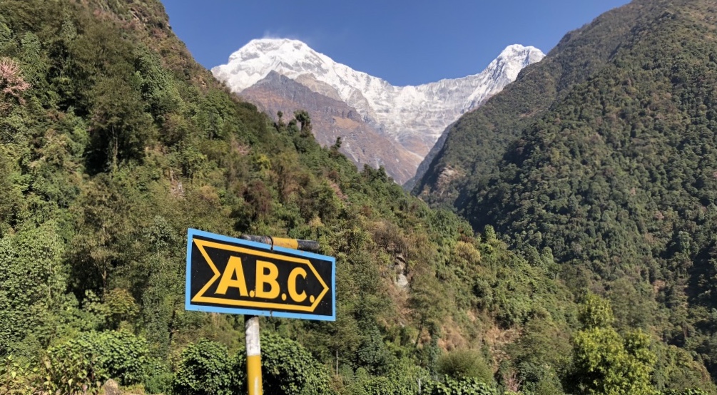
ABC is a straightforward out-and-back trek with a half-dozen settlements along the way, starting at an elevation of 324 meters/1,070 feet, and topping out at base camp at 4,100 meters/13,550 feet. Guide books recommend 10 days; I did it in five, and I met a elderly Swiss man who ran it in three days! (He's lived in Nepal on and off his entire adult life and this was his twenty-fifth time trekking ABC.)

Mood

I recognized even at the time that I was on autopilot. I had been trekking in the mountains for five weeks at this point, and this would be the easiest and shortest hike I'd do since starting out. I liked the rhythm of waking up early, walking all day, eating dal bhat in the evening and falling sleep early. But my appreciation for my surroundings was getting crowded out by a compulsion to walk as fast and far as I could every day. My fitness and acclimatization made this very, very easy to do, even while I made a feeble effort at asking myself, what's the hurry?

ABC draws a lot of first-time hikers who are looking for great views without the punishment of high, high altitude. By contrast, I was ripping down the trail at a pace that made the guides and porters look at me funny.

Day 1:

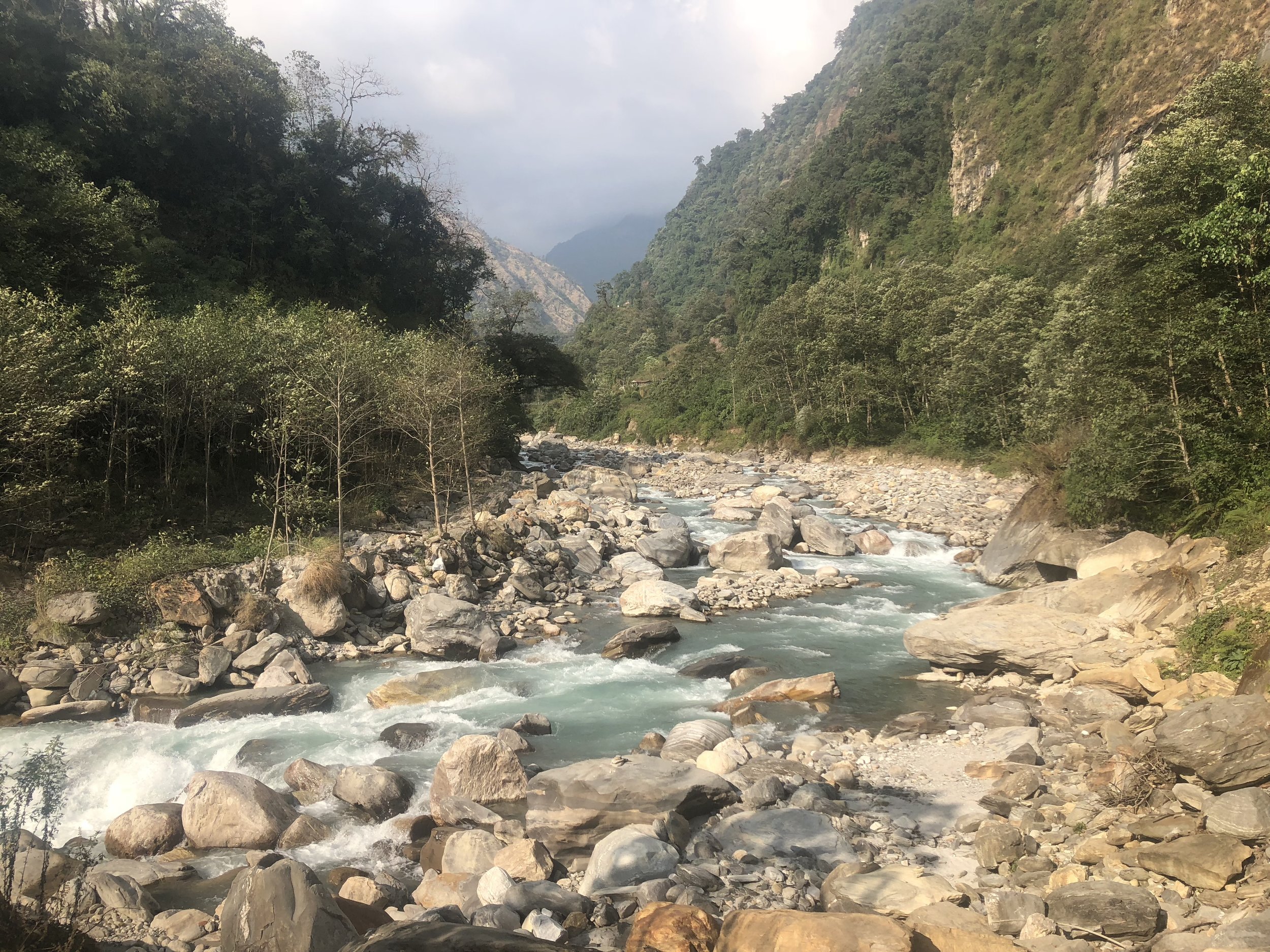
I took a jumpy, uncomfortable bus ride from Tatopani sandwiched in the back seat with five teenage boys who shared their oranges with me, arriving in Naya Pul in the afternoon. I got a Jeep ride into the Annapurna Sanctuary, up to the end of the road and the start of the trail and hiked a few hours to New Bridge. (Truly, the new metal suspension bridge is so much nicer and way more secure than the old wooden plank bridge.)

pUeUASZhTRqkUmFdN51AMQ.jpg
UNADJUSTEDNONRAW_thumb_323.jpg
UNADJUSTEDNONRAW_thumb_377.jpg
UNADJUSTEDNONRAW_thumb_324.jpg
pUeUASZhTRqkUmFdN51AMQ.jpg UNADJUSTEDNONRAW_thumb_323.jpg UNADJUSTEDNONRAW_thumb_377.jpg UNADJUSTEDNONRAW_thumb_324.jpg

Day 2:

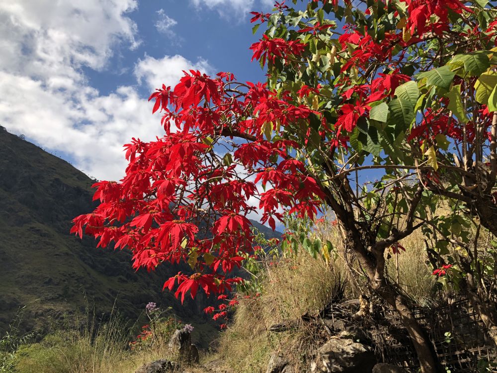
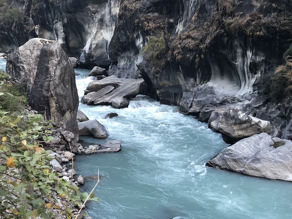
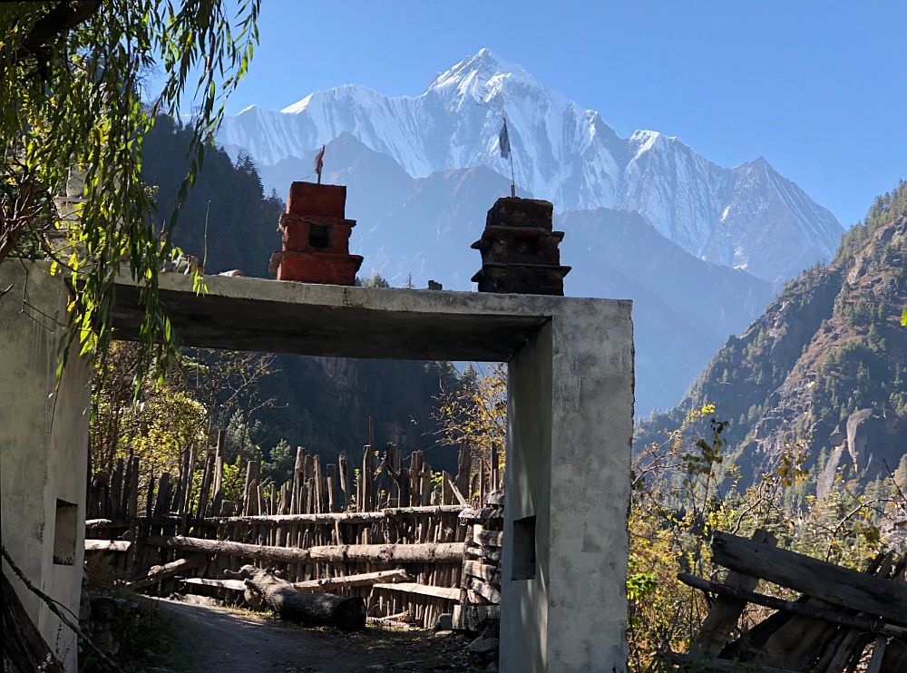
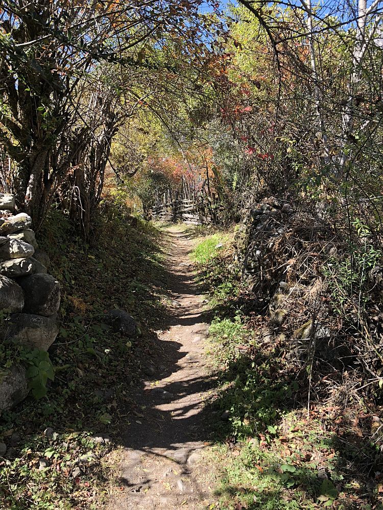
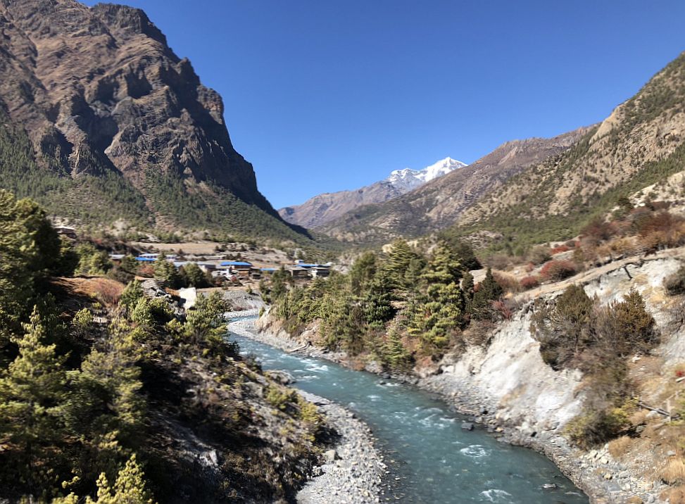
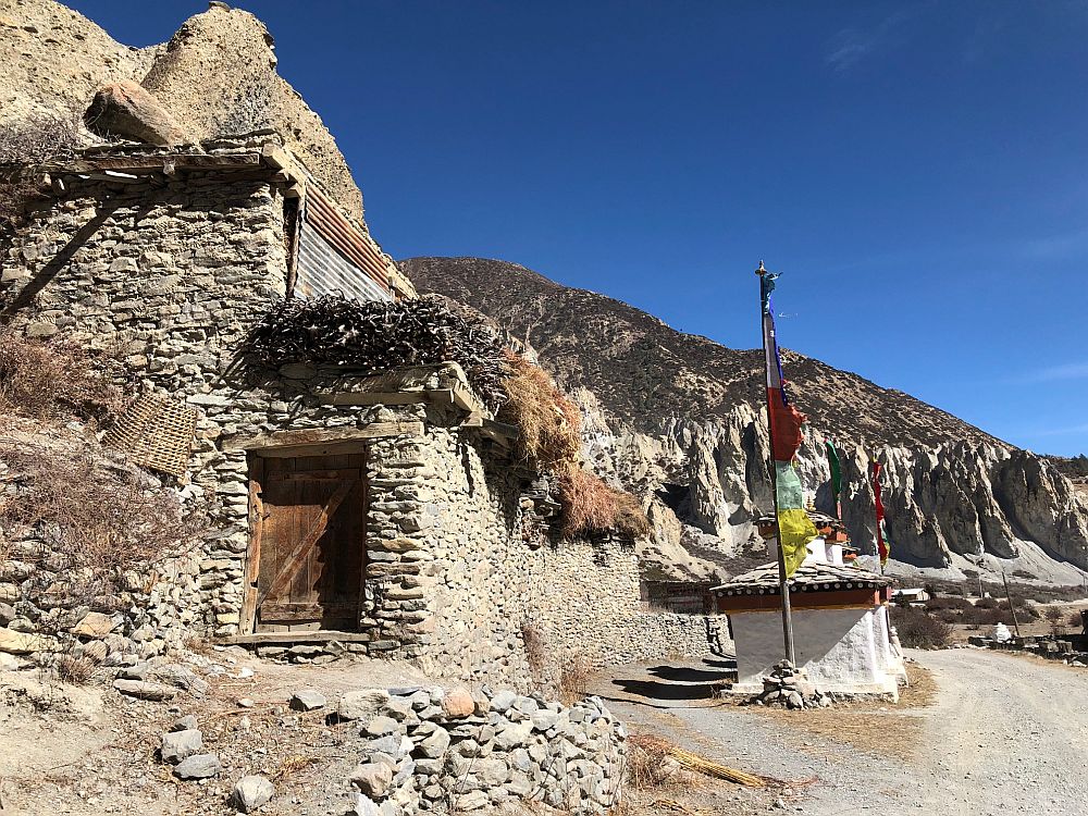
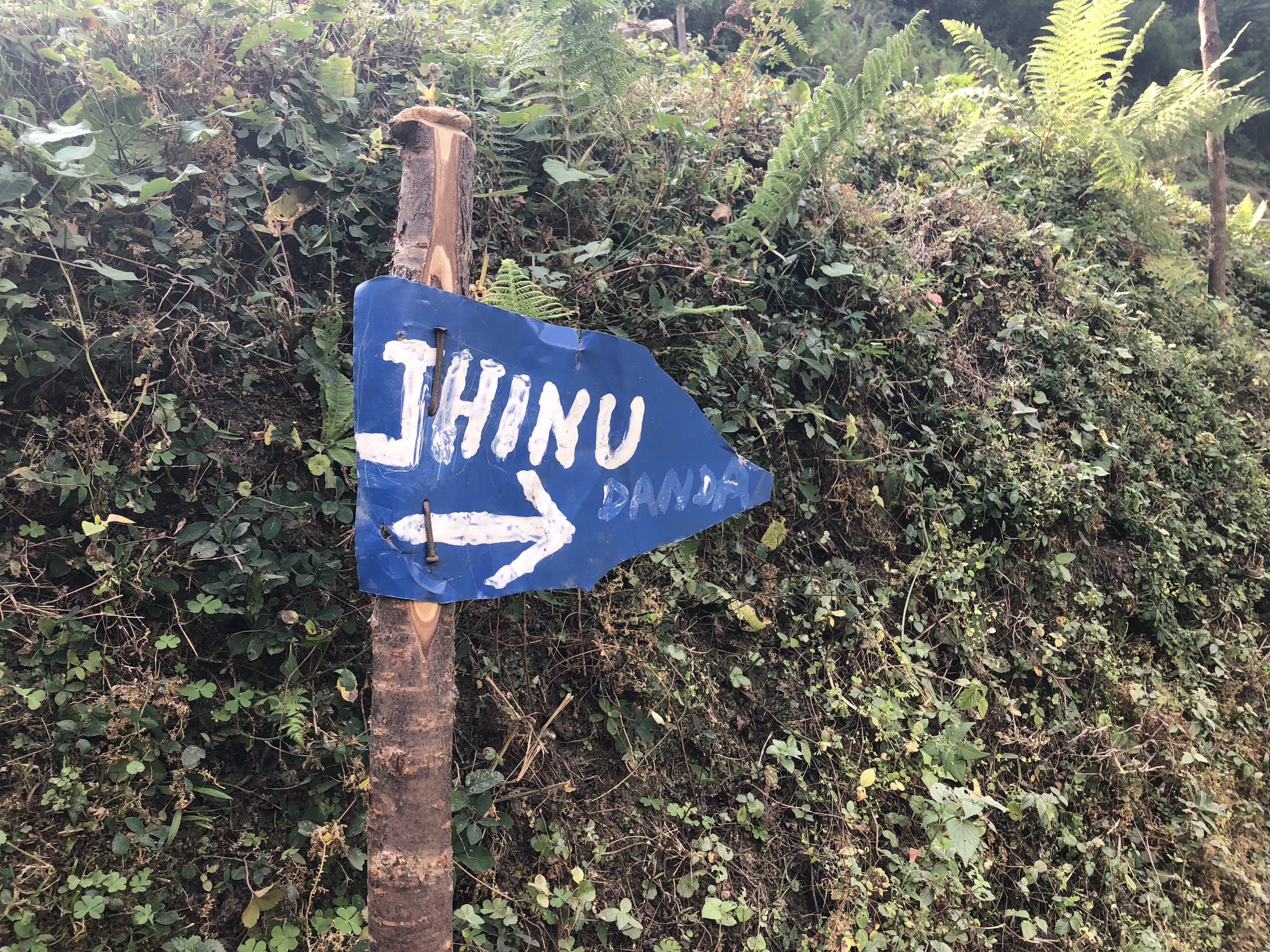
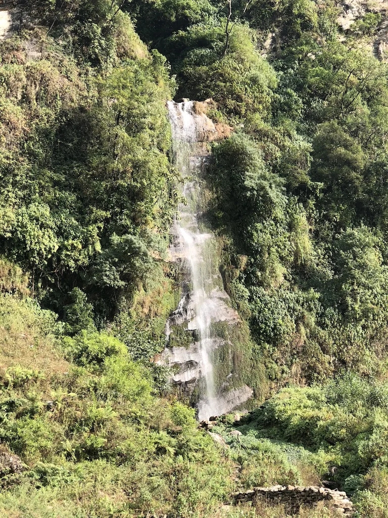
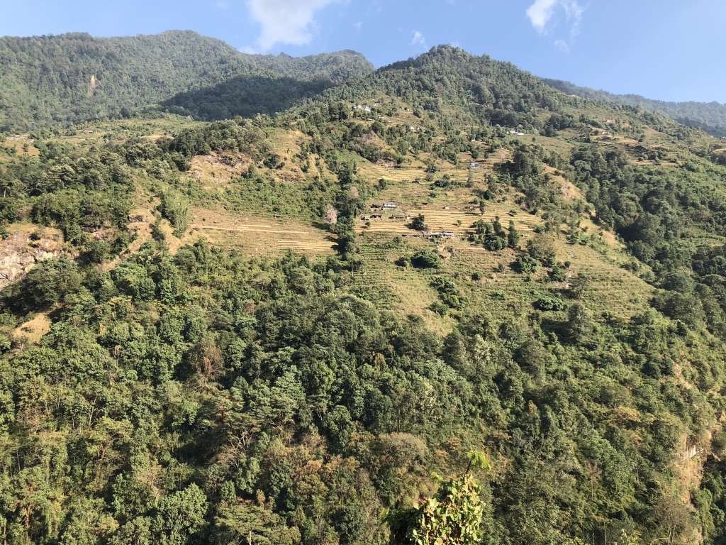
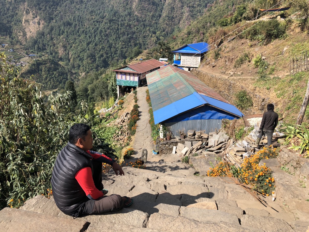
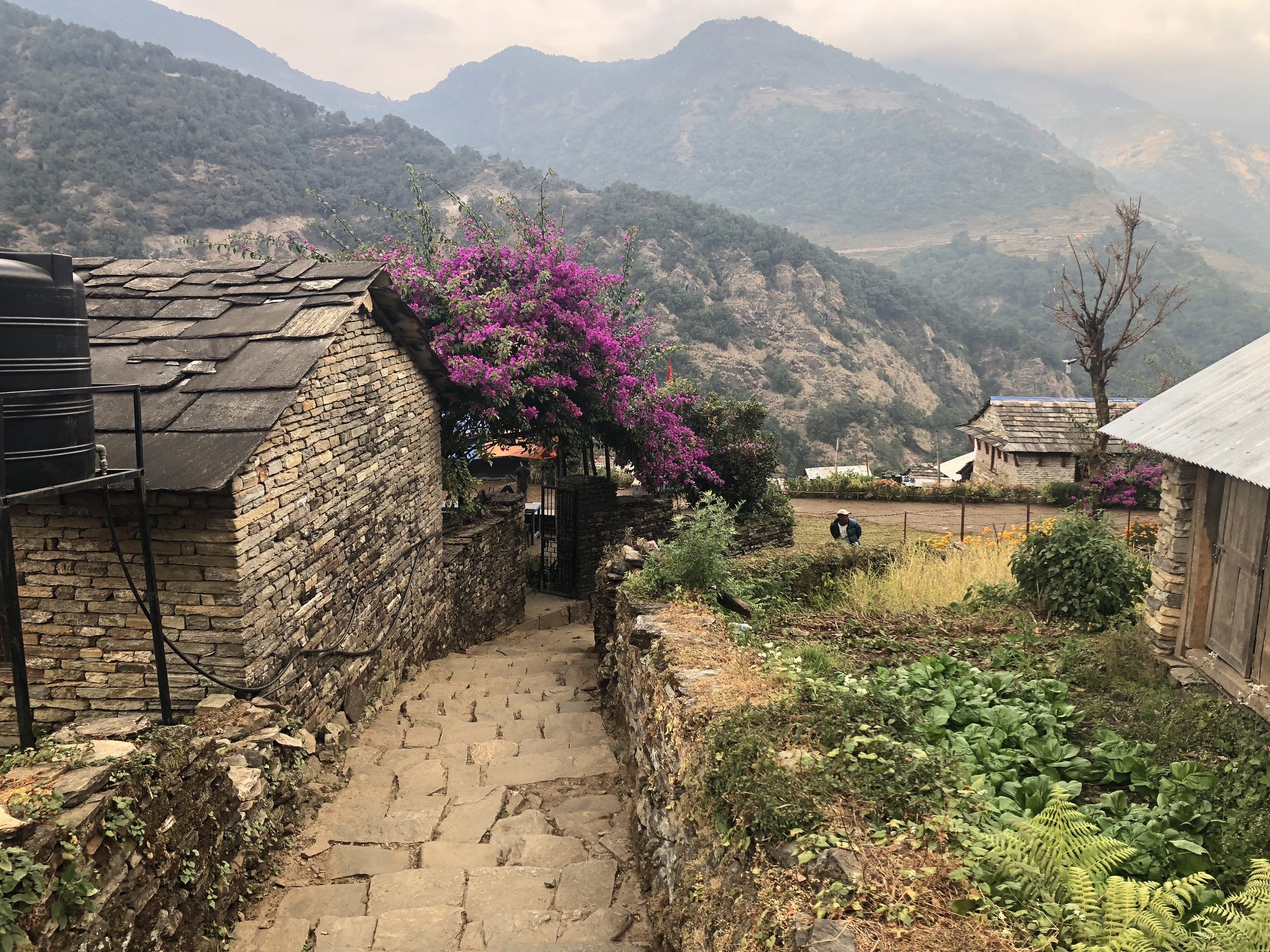
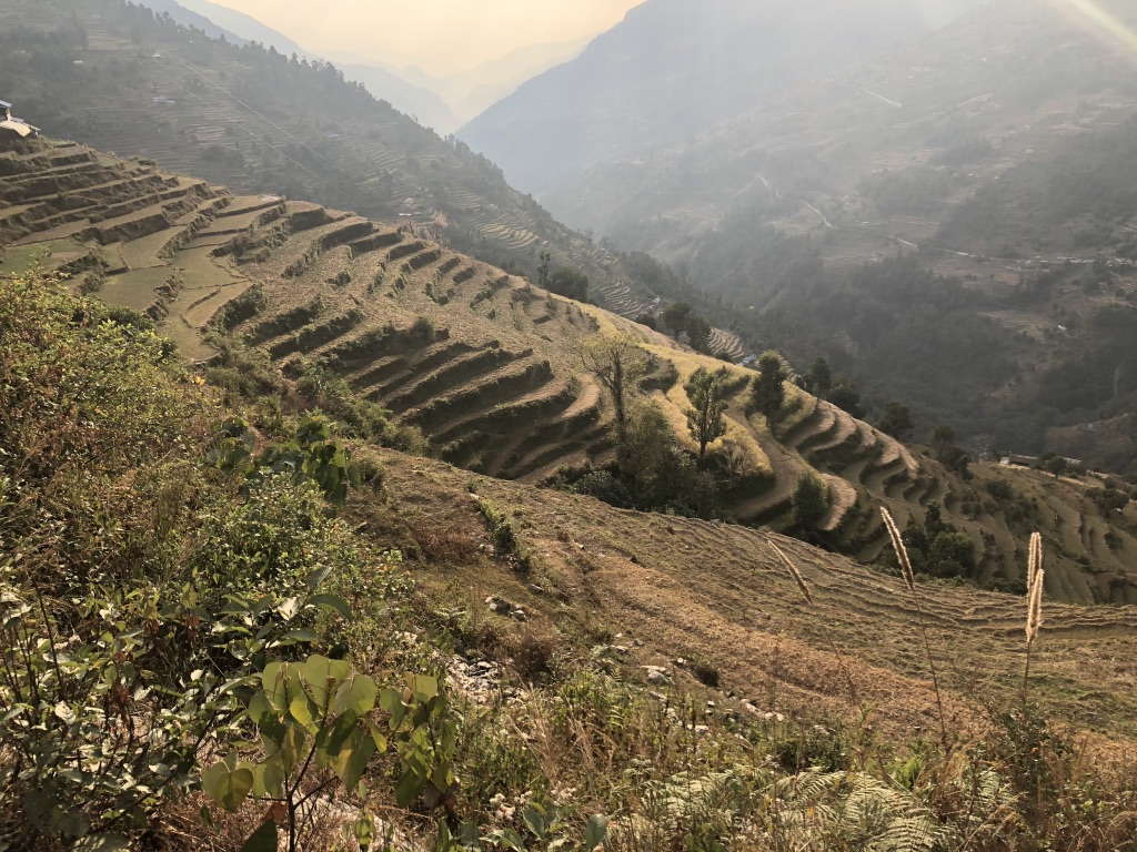
Still at low and lush elevation, I hiked up and down over foothills and river valleys through Jhinudanda to Chhomrong, through Sinuwa, then Bamboo, Dovan and finally stopping at Himalayan Hotel (not an actual hotel, just three lodges tucked together on a trail). Chhomrong is lovely settlement of lodges, cafes and places to buy supplies, scattered up and down a hillside that looks up the river valley to the mountains. Lots of steep stone pathways run through town, I took one of them a little further off trail than I meant to. I was sitting at small clearing looking at my map and eating snack when a teenager came through carrying a massive load of branches on her back and head. I offered her water, and she looked at pictures on my phone while we took a break in the shade. We didn't have any language in common, but it was easy to deduce that a white person is a trekker and asked me, "ABC?" Then we shared a chocolate bar and she led me back up the stone path to the right trail.

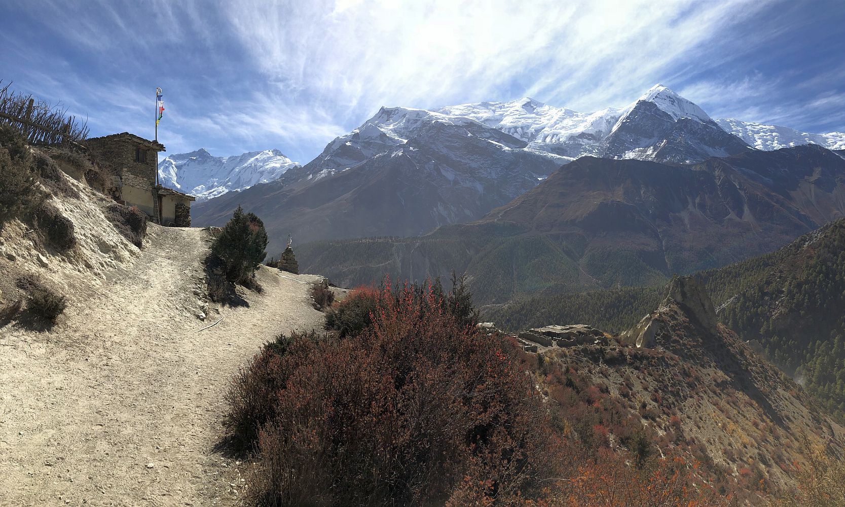
From Sinuwa on, the trail ascends steadily through one river valley heading both north and higher in altitude. Vegetation starts to change and the landscape feels less like a jungle forest, and more like a mountain climate. At Himalayan Hotel, I met an awesome group of solo travelers over dinner and got a bed in dorm room with 5 guys each from different countries. It felt like being at camp, all of us in our tiny beds laughing and telling stories as we fell asleep.

UNADJUSTEDNONRAW_thumb_368.jpg
ICa7k3IpSiGo3Ndry1FY0w.jpg
UNADJUSTEDNONRAW_thumb_364.jpg
UNADJUSTEDNONRAW_thumb_368.jpg ICa7k3IpSiGo3Ndry1FY0w.jpg UNADJUSTEDNONRAW_thumb_364.jpg

Day 3:

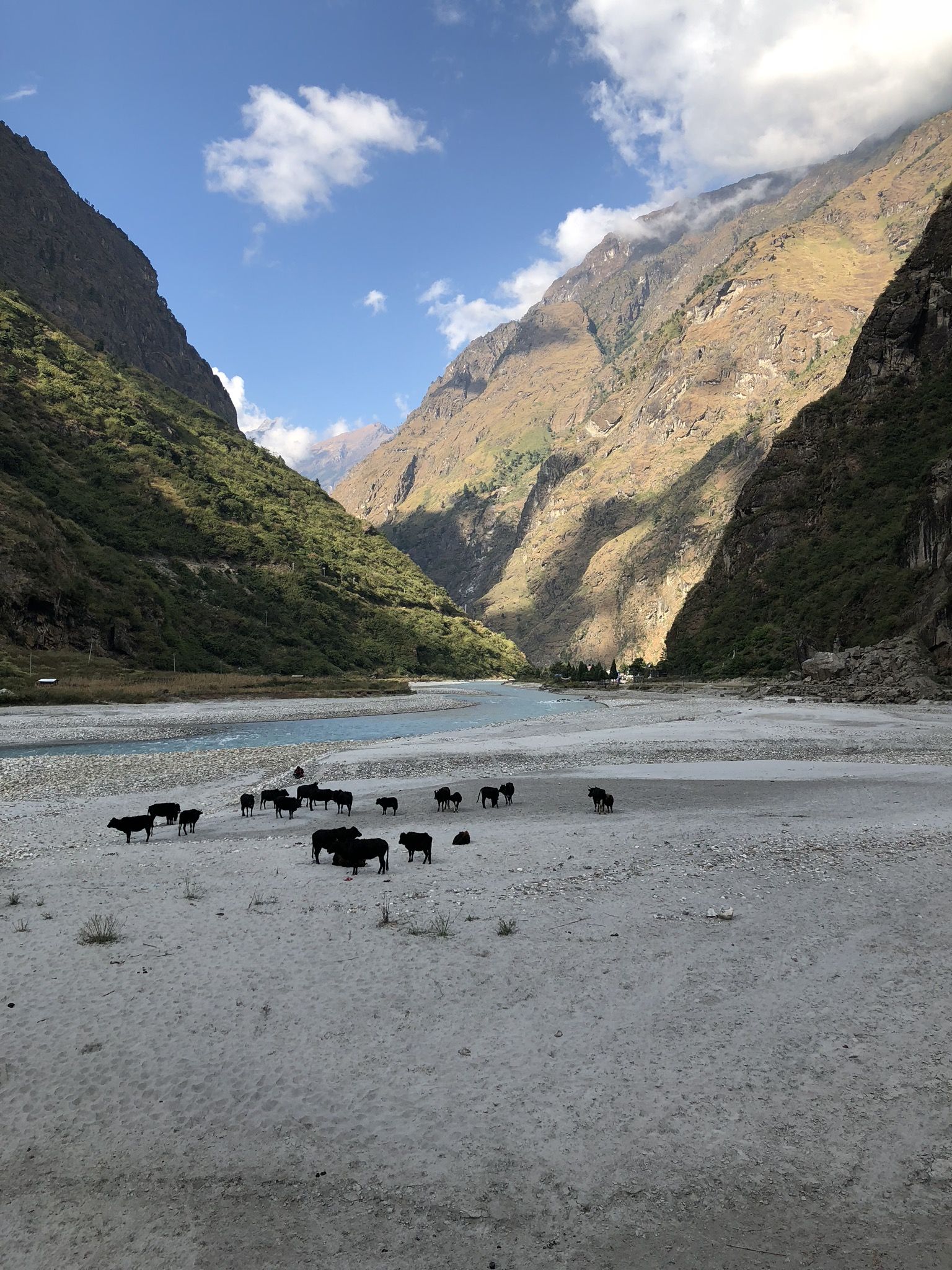
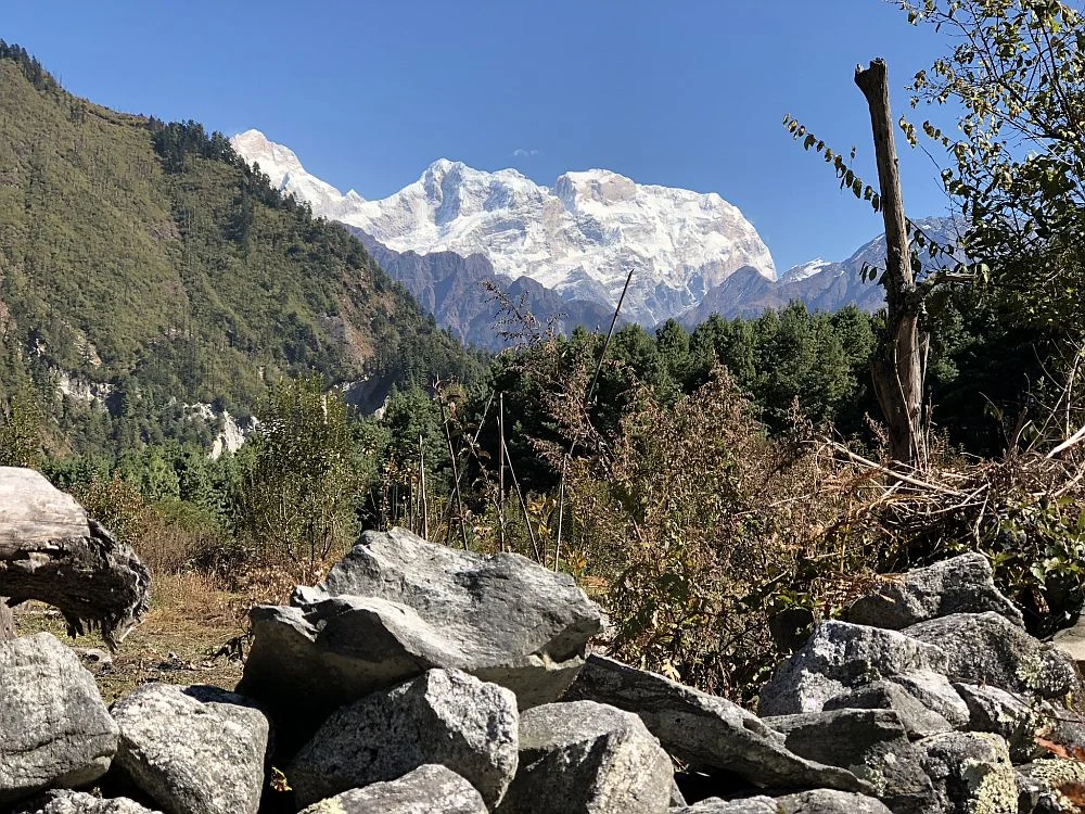
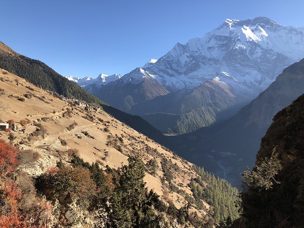
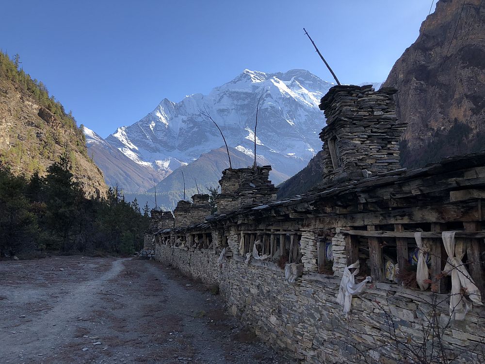
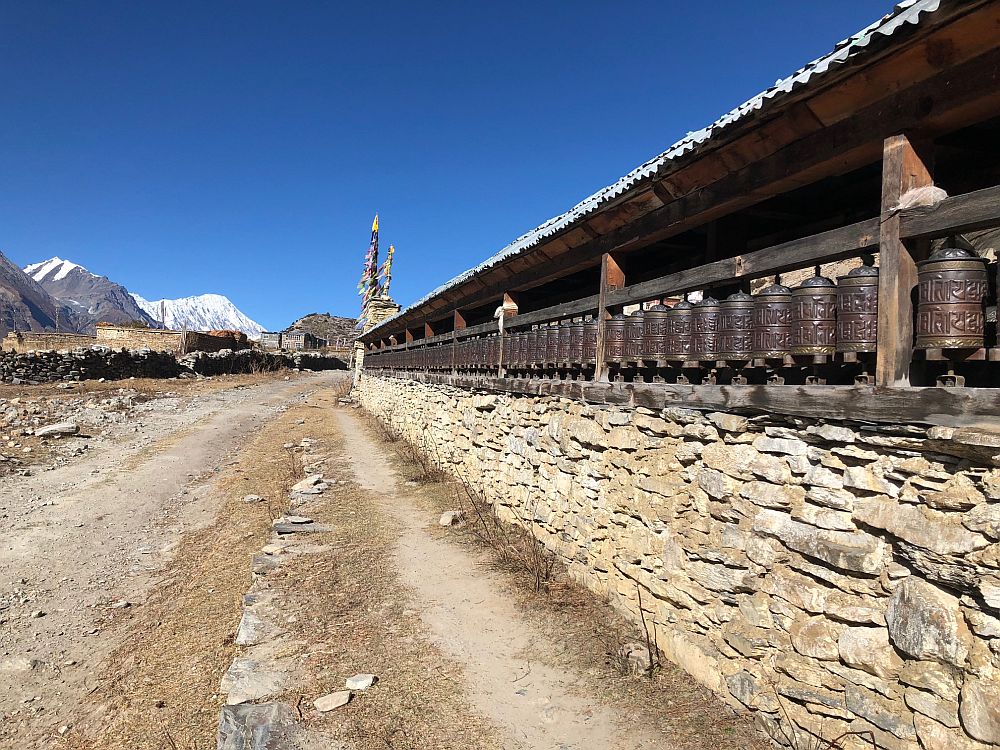
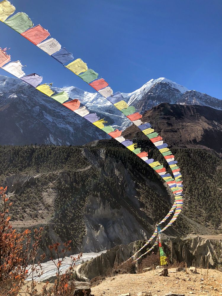
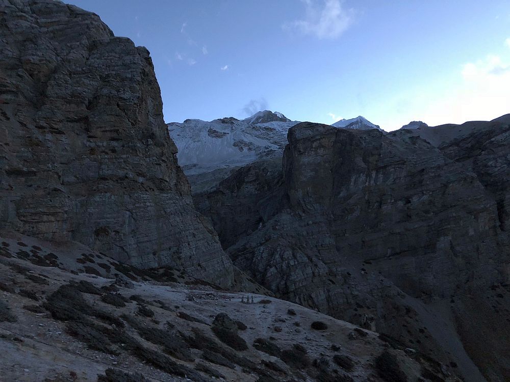
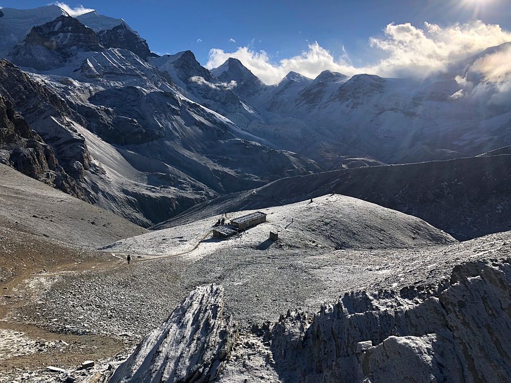
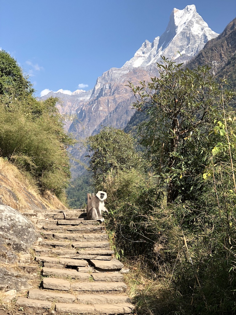
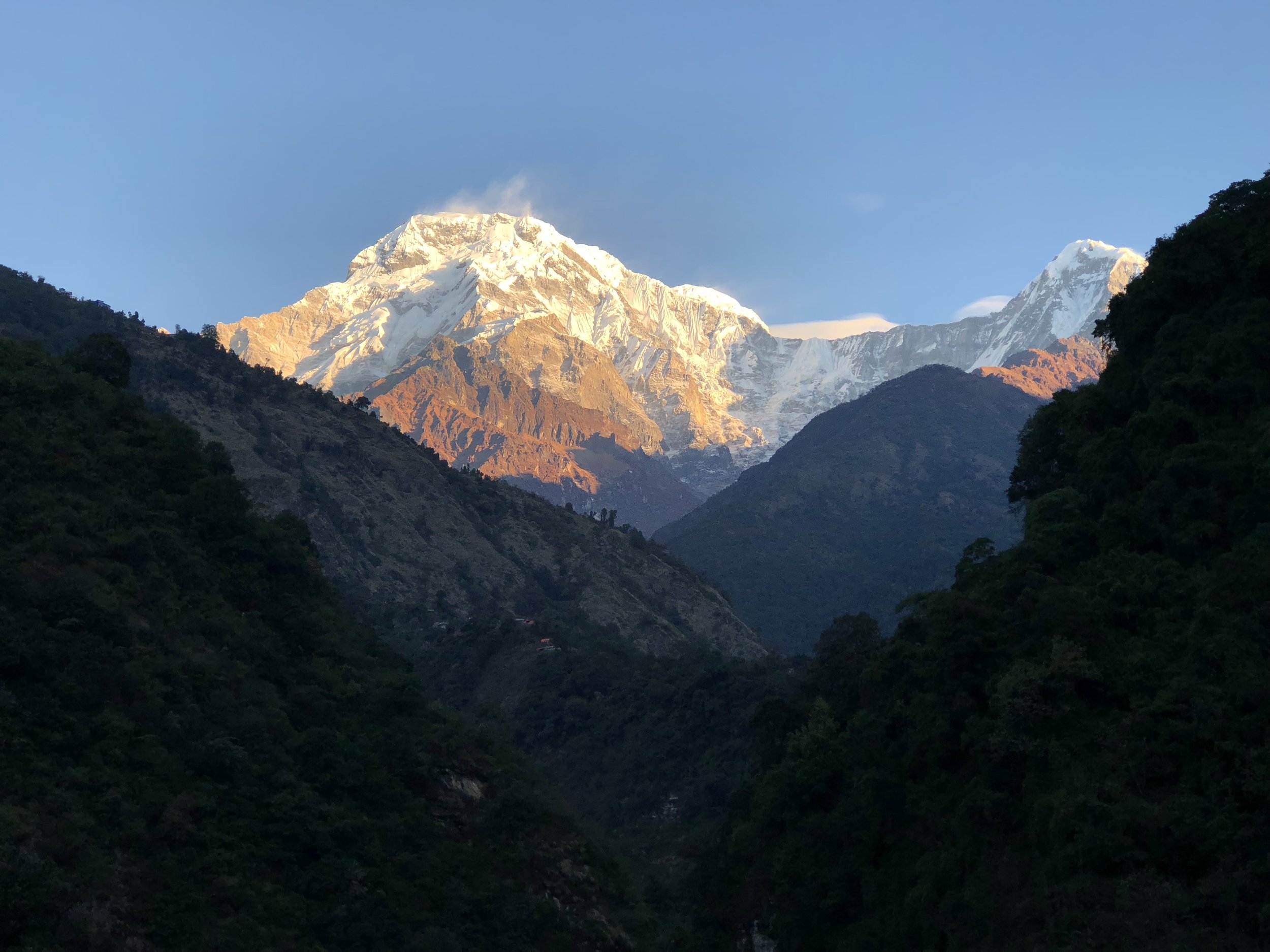
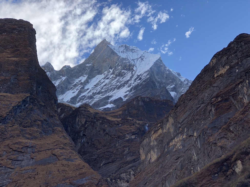
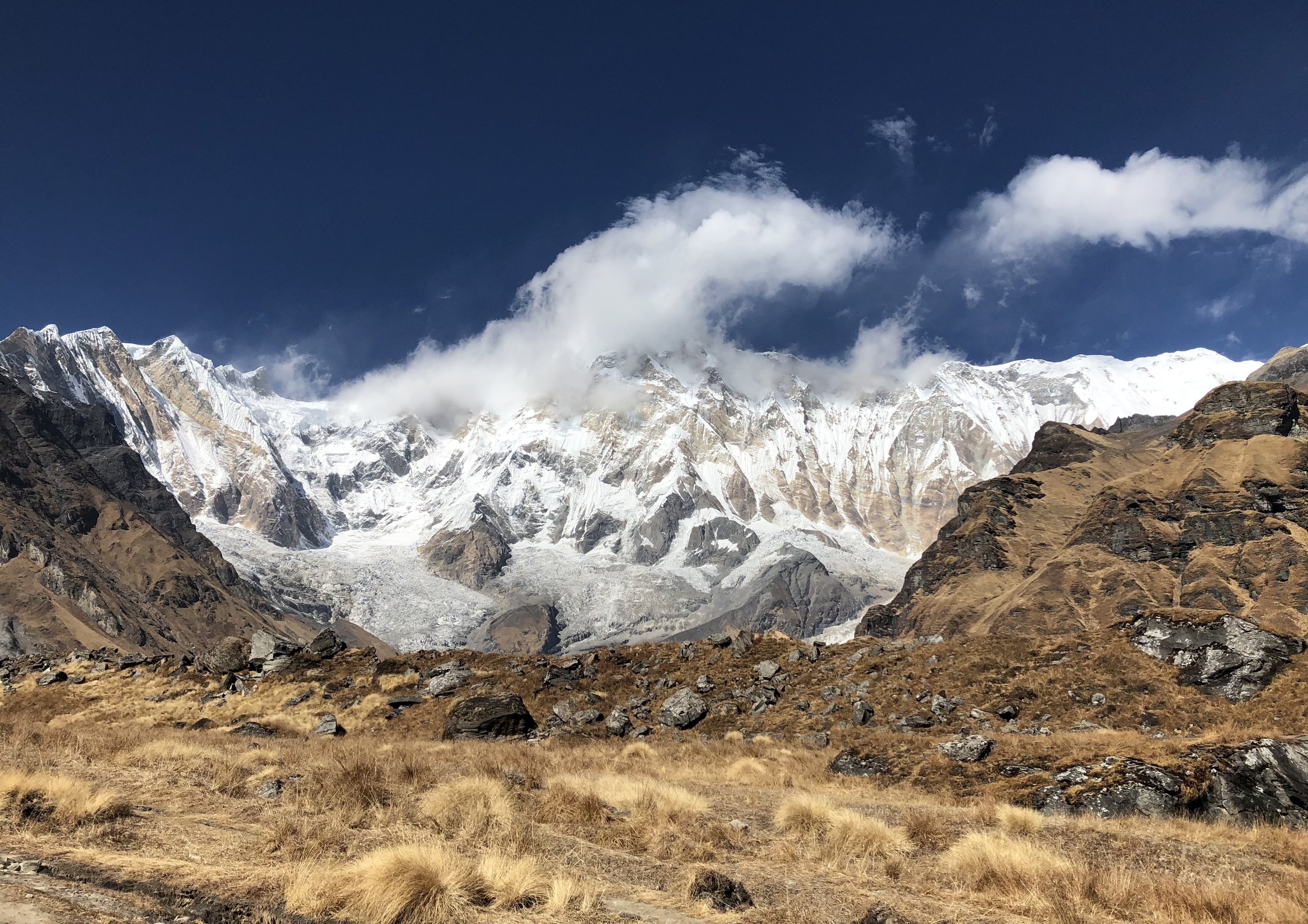
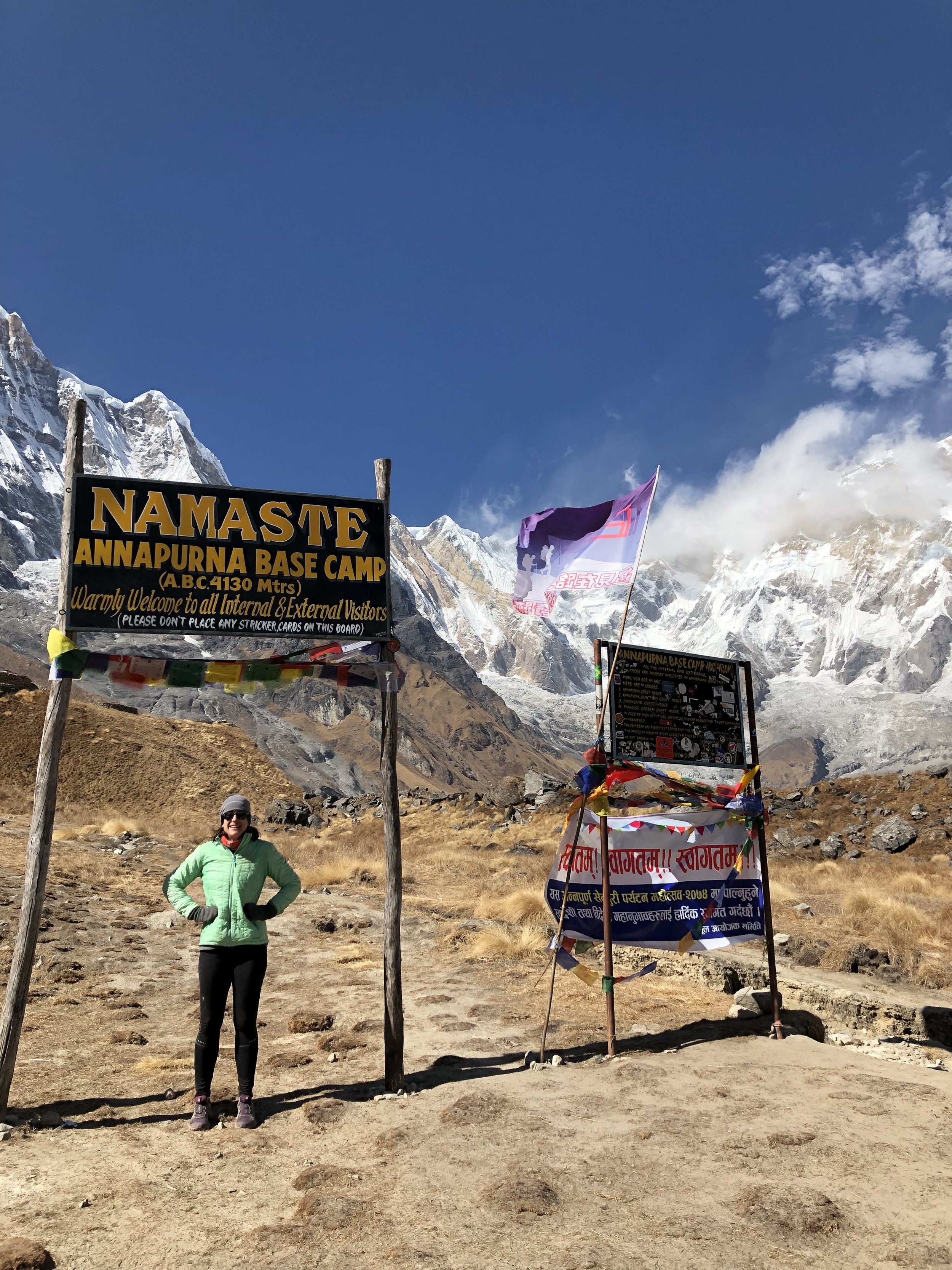
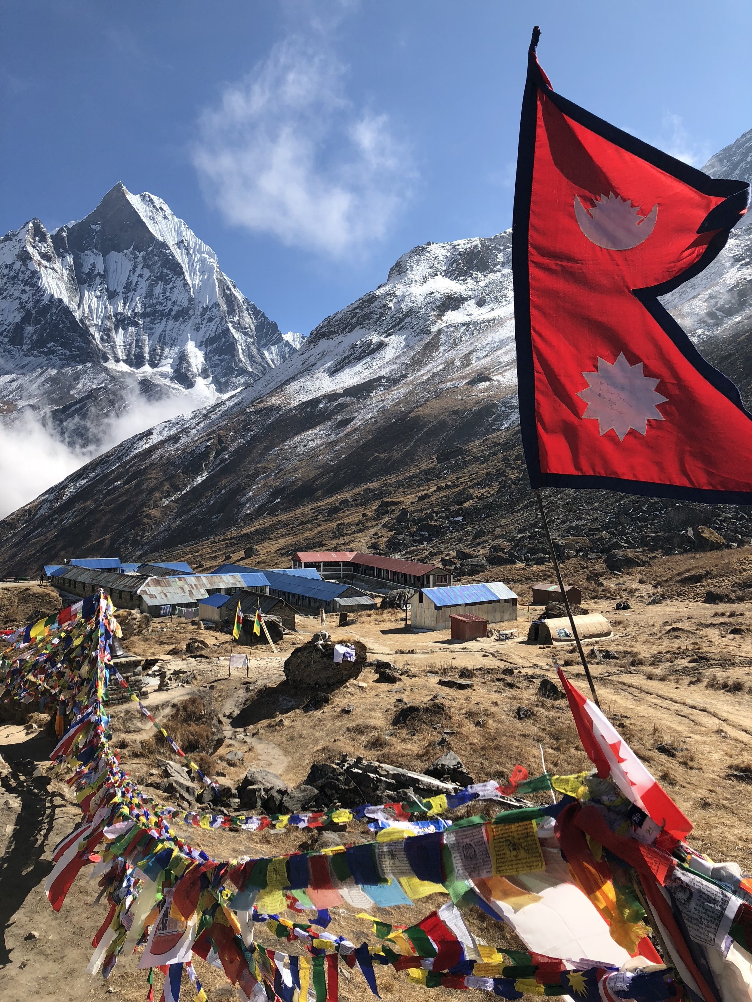
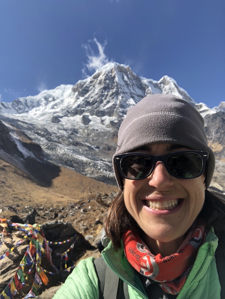
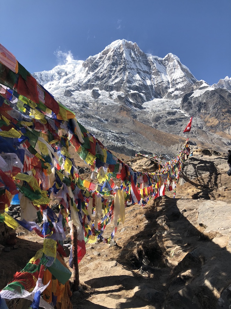
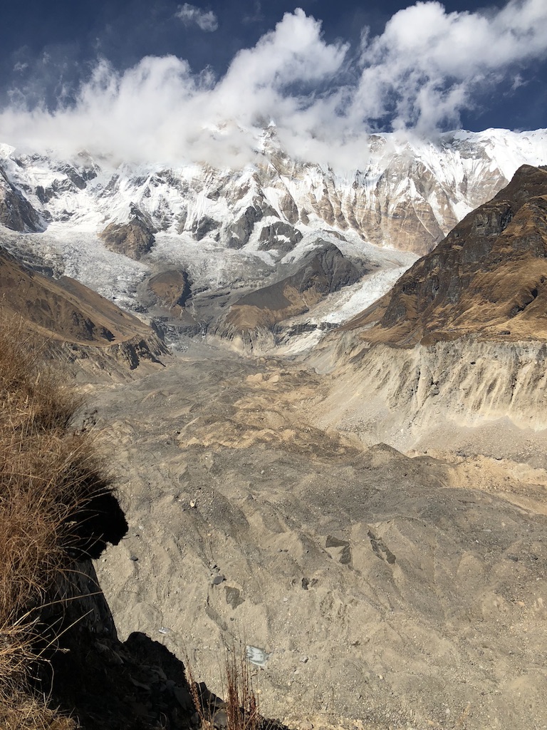
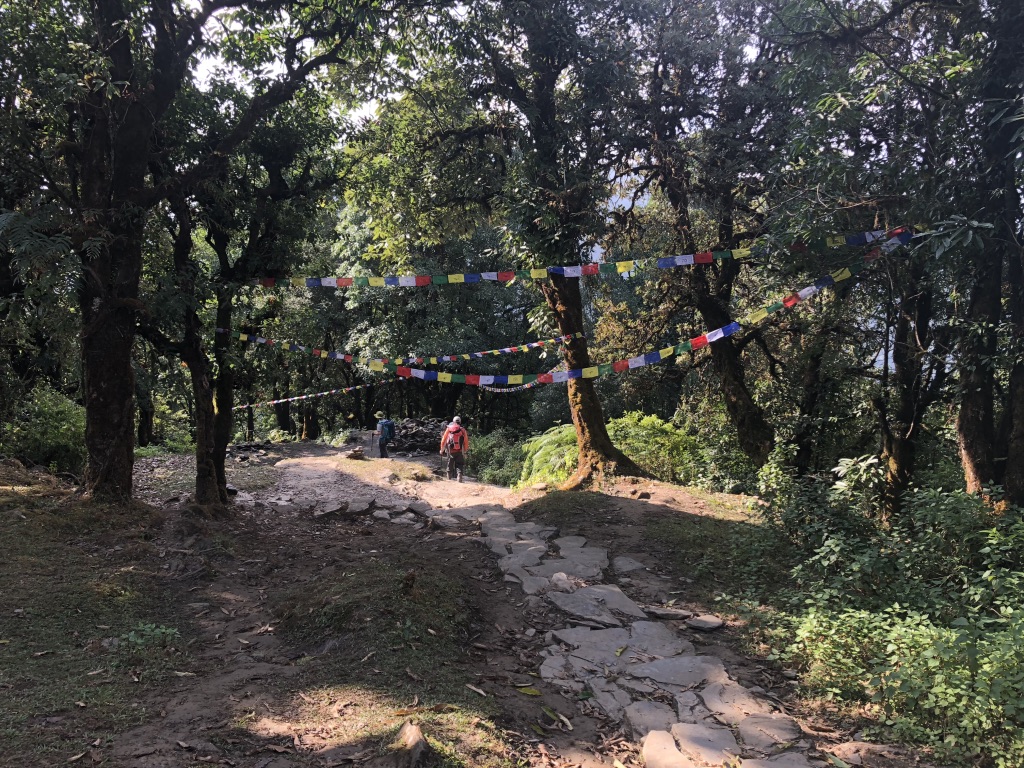
Ascent! I trekked through Deurali up to Machhapuchhre Base Camp (MBC), where I warmed up with soup and wardrobe adjustment and reunited with two of the people I'd met the night before. From MBC, the altitude started to impact my speed and breathing, all the trees had long since disappeared, and I walked up the last rocky beautiful valley with the mass of Annapurna I directly in sight. Base camp is a few lodges at the edge of massive receding glacier. Staring you in the face is the expansive steep wall of the Annapurnas, and all around you the prayer flags stretching among memorials to dead mountain climbers are snapping loudly in the wind.

After a bowl of warm lentils at base camp, I walked back down to MBC, back through Deurali and Himalayan Hotel, and stopped at Doban just at sunset and right before a rainstorm parked itself for the night. On my way to Deurali, I stumbled hard and came away with scrapes on my forehead and nose, giving me plenty of opportunity to wonder again why I was hurrying so much. At Dovan, all the lodges were full but an incredibly nice woman from the UK shared her room with me and I fell asleep with Neosporin on my nose, listening to rain pound the metal roof.

MvMK3vcFQNSGJVOqoMQVMA.jpg
BC5bEUIASHKn4rP6dfJ0fg.jpg
r37HgLFEQLuNDUfkFXsW2g.jpg
UNADJUSTEDNONRAW_thumb_34d.jpg
UNADJUSTEDNONRAW_thumb_344.jpg
UNADJUSTEDNONRAW_thumb_343.jpg
MvMK3vcFQNSGJVOqoMQVMA.jpg BC5bEUIASHKn4rP6dfJ0fg.jpg r37HgLFEQLuNDUfkFXsW2g.jpg UNADJUSTEDNONRAW_thumb_34d.jpg UNADJUSTEDNONRAW_thumb_344.jpg UNADJUSTEDNONRAW_thumb_343.jpg

Day 4:

Thanksgiving Day. Over breakfast with a British woman, a Chinese man and two Nepalese men, i told them it was Thanksgiving in America and they enthusiastically launched into a discussion of Black Friday. Horrified, I tried to explain that's not what Thanksgiving is about but they were more interested in how stores coerce people into lining up on a holiday. "I wouldn't wait in line at midnight for anything," the British woman said. "Unless it was a kidney I needed,  guess."

I cruised back through Bamboo, revisiting the spot where I had encountered a black-faced langur two days earlier, and hearing the monkey-like animals jumping and swinging through trees all around me. In Chhomrong, I stopped for a real cup of coffee and a real piece of pie at a really fake German bakery. I was back in the terrain of climbing up and down from one river valley into the next, headed through Jhinudanda, back to New Bridge. I had hiked into the region on the west side of the river, but at New Bridge I crossed over to the east side to walk southeast toward the town of Phedi and the road the Pokhara. The late afternoon took me through Landruk and Tolka, where I encountered a final, short wooden suspension bridge that was the worst-looking bridge I had encountered. I stared at it for awhile, contemplated the map, complained out loud, "Seriously?!" to absolutely no one, and then I just went for it. I felt relief stepping onto the stone at the far side. Thanksgiving dinner that night was dal bhat with a woman from Poland, and something approximating apple pie.

S8at8To9SS6YdGKidBXibQ.jpg
Lmazp%YuRESBAvFxudj8%A.jpg
UNADJUSTEDNONRAW_thumb_30c.jpg
UNADJUSTEDNONRAW_thumb_317.jpg
S8at8To9SS6YdGKidBXibQ.jpg Lmazp%YuRESBAvFxudj8%A.jpg UNADJUSTEDNONRAW_thumb_30c.jpg UNADJUSTEDNONRAW_thumb_317.jpg

Day 5:

Just a few short hours up and over to Dhampus, and down into Phedi. As I walked, the jungly warm feeling of the lowlands was back in force, and way more people were on the trail. Trekkers who were just starting out from Phedi told us that the upcoming election had prompted a transportation strike and no buses were running between Phedi and Pokhara. Damn. I was little worried about this would shake out, but as soon as I reached the trailhead, there was a car parked with two big backpacks leaning against it. Moments later, two trekkers from Turkey and their driver walked up, and easily agreed to let me split the fare with them back to Pokhara.

Thanksgiving was a meaningful coincidence with my last night of trekking. Despite my hurry and impatience on this final trek, I was also full of appreciation for the people I had met on the trail, the bracing weather and scenery and the physicality of the effort.

[Annapurna Base Camp: November 20-24, 2017]


December 02, 2017 /Patti Daniels
nepal, trekking, Annapurna, ABC, MBC
Comment
The trail from High Camp snakes up the valley to Thorung La, the high point on the Annapurna Circuit. Prayer flags can be seen on the ridge to the right as the sun rises.

The trail from High Camp snakes up the valley to Thorung La, the high point on the Annapurna Circuit. Prayer flags can be seen on the ridge to the right as the sun rises.

Nepal Trek 3: Annapurna Circuit

November 28, 2017 by Patti Daniels

"Ugh, the roads! Annapurna isn't the same as it used to be." Variations on this statement had me questioning whether traveling out to Pokhara for this trek was worth it. But if roads are encroaching on what has been called one on the world's most classic hiking trails, then I better go now before it gets worse, I figured. Plus, I can't begrudge people in this region wanting to build roads and infrastructure. It's a bit precious to prioritize a nice walk for tourists over quality of life for locals.

The circuit is a horseshoe-shaped arc that starts east of Pokhara at Besi Sahar, travels counter-clockwise (advisably) through river valleys, climbs one high altitude pass at Thorung La, runs down through the Mustang Valley and around to the foothills west of Pokhara. Already acclimatized, I was able to cut out the rest days and I modified my start and end points, all of which made this trek faster than expected -- just nine days.

The Route

From Besi Sahar, I followed advice to take a Jeep up to Syange (1,211 meters/3,996 feet) and stayed my first night there. From Syange, my overnights were at Dharapani, Chame, Ngawal, Manag (two nights), Yak Kharka, Thorung Phedi, over the high pass of Thorung La (5,416 meters/17,872 feet) during the day and down to Jharkot, and then finishing in Jomson.

pointsettia.jpg
river.jpg
tal.jpg
annapurna-massif.jpg
koto.jpg
pointsettia.jpg river.jpg tal.jpg annapurna-massif.jpg koto.jpg

The trail traces the bank of the Marsyangdi Nadi river from Besi Sahar all the way to Manang. While the river is your constant companion, the shape and current of the water changes constantly, along with the vegetation. I was stunned to see wild poinsettias flowering on trees in the early, low elevation days of the trek; apparently I thought they only grew in plastic pots at grocery stores between Dec 10-25. After a few days the elevation barely scratched 2,000 meters (6,600 feet), making for warm days and fast trekking. The walk through an autumnal woods and a valley filled with apple trees near Timang made me nostalgic for Vermont. Just beyond there, nearing Chame, we emerged around a bend in the trail and the mass of Annapurna II was directly in sight. These are definitely not Vermont's Green Mountains!

This was the stretch of trail where I met Mathilde, and later Tavis, Florianne, Kinga, Mike, Adam and Selena, cheerful and easy trail companions all. We hiked together from below Chame to Upper Pisang, and then I continued solo that day to Ngawal, a long, satisfying day that finally put me at a respectable elevation, 3,660 meters/12,078 feet.

apple-trees.jpg
ghyaru.jpg
brahtang.jpg
lower-pisang.jpg
prayer-wall.jpg
apple-trees.jpg ghyaru.jpg brahtang.jpg lower-pisang.jpg prayer-wall.jpg

From Ngawal, I had an easy, short walk to Manang, the Namche of the Annapurnas. Here, they recommend you stay put to acclimatize for a few days, stock up on supplies and prepare for the high altitude that comes next. I stayed two nights so I could take in a movie (!), check out the political campaigning ahead of the parliamentary elections and do my laundry. I had my blood oxygen tested at the Himalayan Rescue Association and it was an impressive 92 percent, so I sped out of there and up to Yak Kharka after a day and half.

ngawal.jpg
ngawal-prayerwheels.jpg
Bhraka.jpg
Ghusang2.jpg
Ghusang-flags.jpg
yak-kharka.jpg
ngawal.jpg ngawal-prayerwheels.jpg Bhraka.jpg Ghusang2.jpg Ghusang-flags.jpg yak-kharka.jpg

Manang is full of "video projection halls," a fun cottage industry in town that doesn't offer much else in the way of distraction. A Slovak couple and I caught the 5 p.m. showing of Seven Years In Tibet; the wooden benches had yak furs to keep us  warm, and the projectionist lit the yak dung stove too. (Lighting the stove is the most expensive part of the operation for the projection hall.) Halfway through the film, a woman brought in popcorn and hot tea for us. Delightful!

manang-movie1.jpg
manang-movie2.jpg
manang-movie1.jpg manang-movie2.jpg

Above Manang, the landscape changes dramatically again and the trek starts to feel like a TREK. Vegetation disappears, the brown, barren mountains in the foreground are lit up with crisp, snow-covered peaks in the distance. Yaks meander down the trail, the dull but cheerful sound of their bells announcing their approach. Here the trail has turned north along the Thorung Kola and Kone Kola rivers, tiny threads of water at the bottom of impressively carved valleys.

Looking south down the Kone Kola river valley, the section of trail between Letdar and Thorung Phedi.

Looking south down the Kone Kola river valley, the section of trail between Letdar and Thorung Phedi.

Thorung La is the high pass on this trek, and the options for accommodation just before making this ascent are few. Thorung Phedi is a cluster of noisy lodges, and further along is High Camp, essentially one noisy lodge. I lucked into the last room at small quiet lodge in Thorung Phedi, on the hill overlooking the rest of the guesthouses. A dozen of us huddled around the stove with cups of milk tea and compared notes on how early we planned to start the ascent.

In the pre-dawn morning, light, dry snowflakes floated in the dark air and I could see a dotted line of headlamps snaking up the mountain trail behind the guesthouse. Their 4 a.m. departure seemed pointlessly early and I waited till first light. I had the benefit of weeks of conditioning and acclimatization, and my climb up to the high pass was fairly easy and speedy. I had expected it might be, but it seemed unwise to presume too much at 17,800 feet.

thorung-sunrise.jpg
thorung-east.jpg
throung-pass.jpg
thoroung-west.jpg
thorung-sunrise.jpg thorung-east.jpg throung-pass.jpg thoroung-west.jpg

Maps describe this as "biggest" mountain pass in the world, I think because it's extremely broad and the flanks on both sides of the pass extend far out. In Three Passes, a sharp knife-edge defined each pass with steep ascent and decent on both sides. This was more of an enormous saddle.

At the top, the signpost is swaddled in bright prayer flags and swarmed with trekkers seeking a quick photo in the windy cold exposure of the pass. Joining the group of trekkers at the top, I heard a British voice calling my name: Stu! We had first met weeks ago on the hike from Jiri to Lukla, on the evening after Andy and I got lost in Bupsa. I had last seen Stu on Three Passes, the night before the first pass when he was expressing extreme dread that he was not cut out for this. And now here he was -- having finished Three Passes he kept going, and now we stood at the top of Thorung La! Stu offered me a celebratory sip of his beer (17,000 feet, 9:30 a.m., drinking a beer - this is definitely not the stressed out Stu I met in Chhukung!) and we toasted the chances of meeting up again precisely at this spot. Fantastic!

IMG_1133.jpg

The 10 kilometer/6 mile decent toward Muktinath and Mustang Valley was long, barren and deceptively tricky. Along the way were bad weather shelters, the fierce blue of their tin sheaths providing a shot of color against the dun-hued landscape. A porter told me these were built after the disastrous 2014 trekking season when a snow storm stranded and killed 43 people on this section of trail. Even in good trekking weather like today, it's easy to see how few options for escape or natural shelter there are on this long, exposed slope; guidebooks everywhere are full warnings to check the weather conditions with reliable locals before attempting this section of trail.

Muktinath offers a celebratory oasis to trekkers coming down from the pass -- bars, hotels, restaurants, a LOT of white people. The vibe of partying backpackers who were a little too impressed with themselves was jarring after a long string of peaceful days in the mountains. I checked in quickly at the TIMS station and kept walking to the village of Jharkot, another half-hour down the road. A nice lodge with hot showers, and the company of a small group of French trekkers made for a good end to the hardest day of the trek. The sun dip below the mountain ridge, and herders brought cows in from the small nearby fields, their bells clanging and hooves clomping as they moved down the narrow stone alley next to our lodge. As we ate our dal bhat dinner, the lodge-owner lit a metal bucket of coals on fire and nudged it under the wooden table where we were eating. Defying the odds but clearly in line with the proprietor's expectations, the table did not catch on fire, and our feet and legs were toasty warm as the temperature dropped outside. Another item added to the list of "Things We Don't Do In America." (Or in France, I was assured.)

The next day was my last on this trek, ending in Jomson. I had debated how to use the time I had left in the region and realized I could either finish walking the low foothill sections of the Circuit Trek, or take a bus to Naya Pul and get in one more trek to Annapurna Base Camp. The hours walking to Jomsom proved to be the most annoying, and most filled with self-inflicted problems of any hours I would spend in the Himalaya, but they could not dull the satisfaction and joy of hiking in this region.

[Annapurna Circuit Trek: November 10-18, 2017]

November 28, 2017 /Patti Daniels
Nepal, Thorong La, jomsom, Annapurna Circuit, Annapurna, mustang, trekking
1 Comment

Powered by Squarespace